 Occasional Papers (2009-)
 Site Visualisations
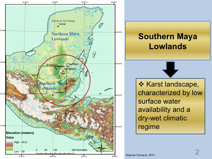
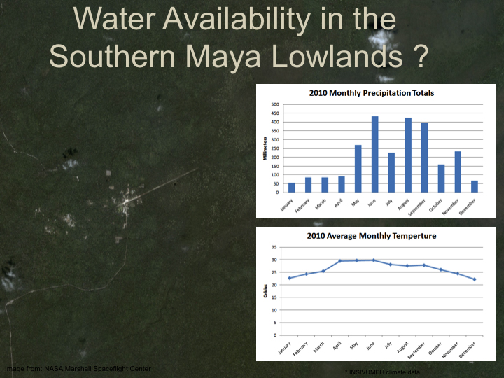
Water has been of paramount concern for the ancient Maya. The karst nature of this landmass and a highly seasonal distribution of rainfall have made the capture and storage of rainwater a necessity for much of the region’s history.
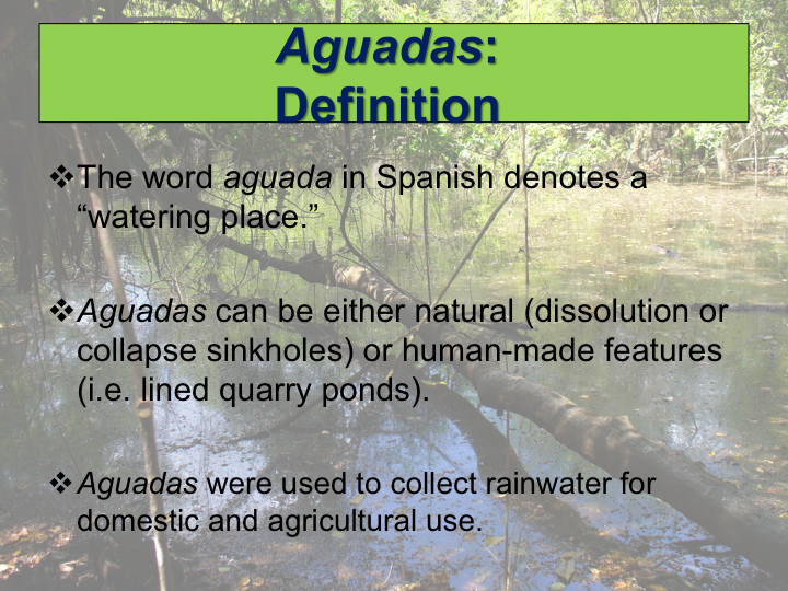
Aguadas are an important but understudied aspect of the ancient Maya civilization’s water management systems. Collectively, thousands of aguadas are found wherever the Maya resided in the seasonally parched interior parts of the peninsula.
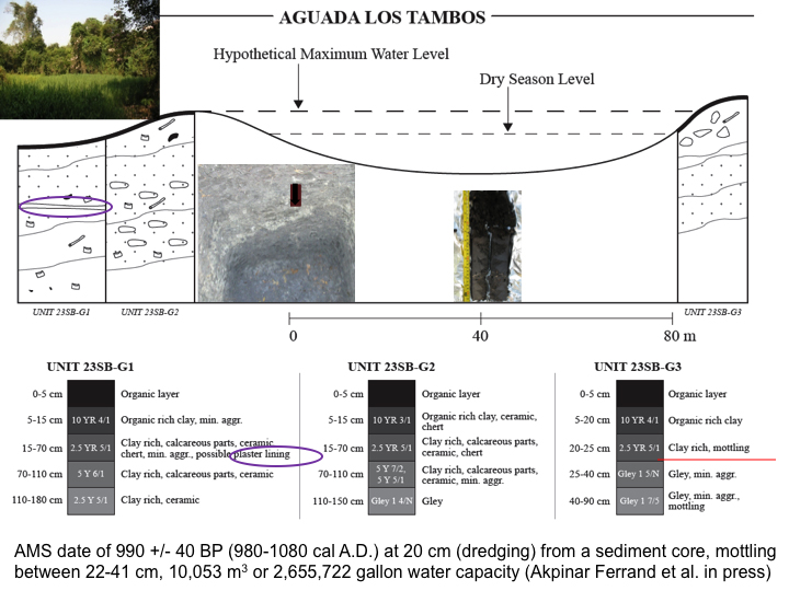
Aguada Los Tambos is situated 2.2 km south of Xultun within the site’s sprawling urban settlement zone. Xultun, located in northeast Petén, 8 km southwest of the site of San Bartolo, was an important Preclassic and Classic period Maya center (Garrison, 2007). Aguada Los Tambos was investigated by Akpinar Ferrand et al. in 2007 for information on ancient Maya's use of the feature. Investigations revealed modification of the aguada through dredging and berm building (to increase water storage capacity), presence of a plaster floor (to collect water for domestic use), and a possible past regional aridity event based on the extensive mottling (oxidation and reduction) seen in the sediment core (Akpinar Ferrand et al. 2012).
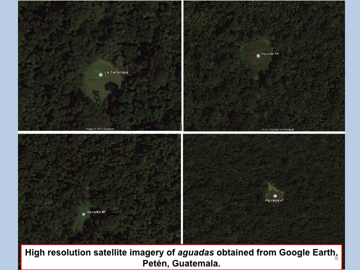
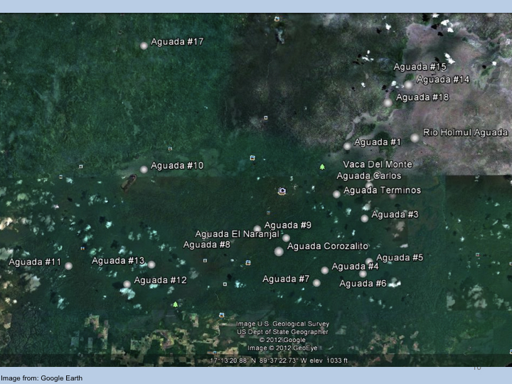
High resolution satellite imagery in Google Earth available for the Tikal National Park in Guatemala made it possible to identify potential aguada locations, some already known through remote sensing analysis and ground-truthed during field research (Thomas, 2010; Dunning et al. 2010). The Google Earth image below displays the possible aguada locations saved as a Google Earth kmz file. Kmz files can be imported into ArcGIS.
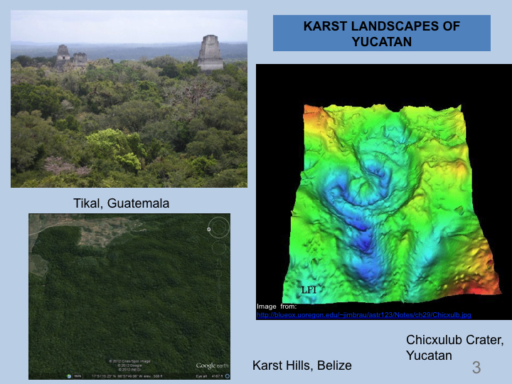
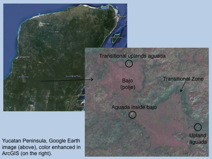
It has been observed that faulting and folding largely control the distribution of natural aguadas in the southern Maya Lowlands, as the limestone dissolution and sinkhole formation is concentrated along fractures created by these processes (Beach et al. 2003, Ramos et al. 2004). In Alta Verapaz, Guatemala, remote sensing studies have shown that synclines direct the spatial distribution of bajos (poljes), and dissolution features such as sinkholes typically form along their main anticline axes (Ramos et al. 2004). In archaeological studies, aguadas have been largely observed at the margins of bajos (poljes) (Bullard, 1960; Siemens, 1978; Dahlin et al. 1980; Dunning and Beach, 1994; Wahl et al. 2007). Siemens believed the suitability of bajo margins for aguada formation or construction was an important reason for attracting early ancient Maya settlements to these areas (1978). In the absence of fractures, limestone dissolution is still observed to take place, yielding a more random and less concentrated spatial distribution (Akpinar Ferrand, 2011).
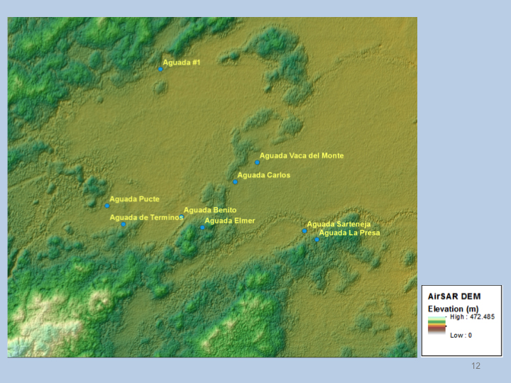
Aguada locations near the site of Tikal with elevation map derived from JPL AirSAR.
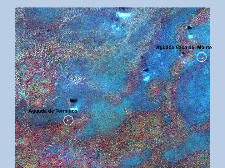
IKONOS 4 meter false color infrared image (4,3,2 band combination). A false color image can show differences in vegetation patterns. Aguada de Terminos and Aguada Vaca del Monte appear as white spots. Bajos appear in various shades of blue, while upland vegetation appear in various tones of red.
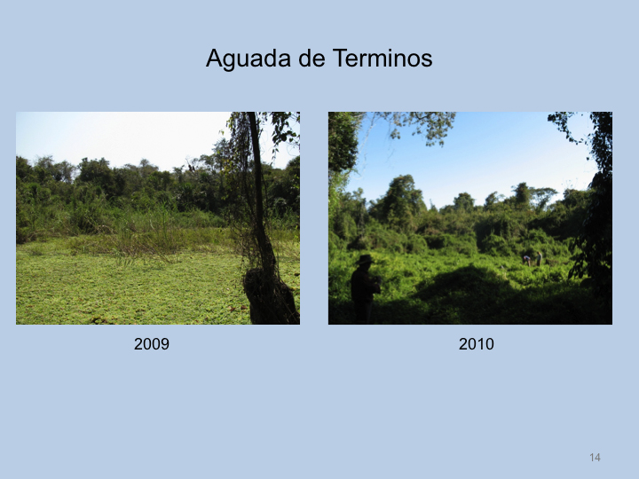
Aguada de Terminos is a sizable aguada at the site of Tikal. Standing water covered with 'water lettuce' Pistia in 2009. Completely dry and covered with vines and sedges in 2010. Annual precipitation and climate variability affects vegetation cover in aguadas during the dry season.
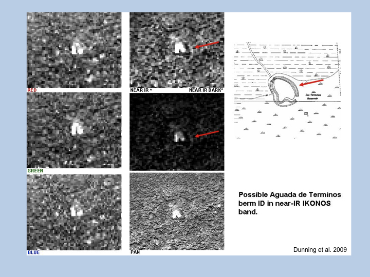
Earlier reports of Aguada de Terminos mentioned the presence of a berm around it (Puleston, 1970), but this was not confirmed. Dunning et al. (2009) analyzed the possible berm through IKONOS red, Near IR, Green and Blue bands.
Tasseled cap transformation makes the boundary between the upland forest, bajo margin, and possible berm around Aguada de Terminos visible. A tasseled cap transformation enhances brightness, greenness and wetness factors in the image.
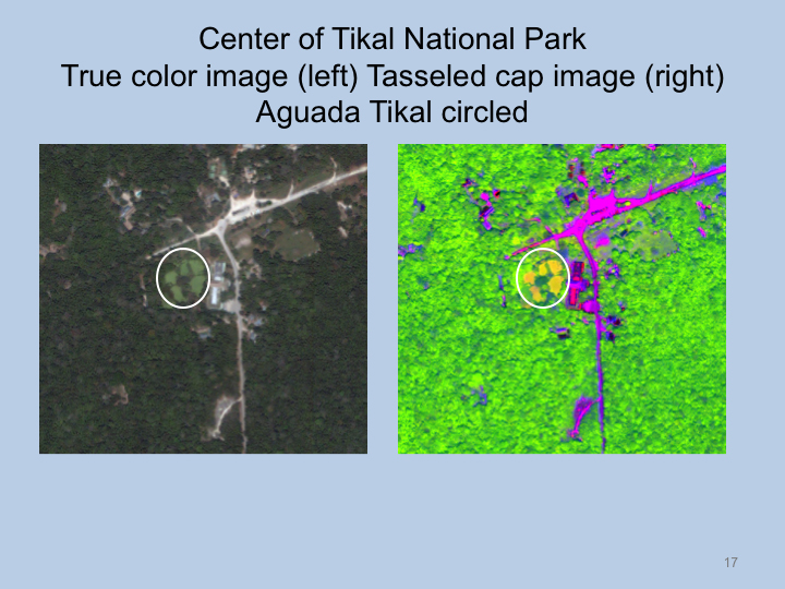
Another example of visualization of an aguada through IKONOS involves the image of the center of the site of Tikal. A tasseled cap transformation was applied to enhance certain physical features using ENVI remote sensing software.
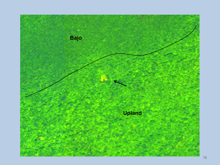
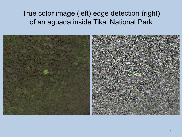
Another technique we utilized to detect and differentiate aguadas from the surrounding canopy involves applying edge detection filtering. The filter is able to enhance edges of aguadas with open canopies.
Copyright:
The authors ensured that permission for the use of images and text from copyright holders have been obtained and that the appropriate citations occur with the image captions or in the text. The authors acknowledge that the use of images published on ArchAtlas in pedagogical/educational presentations and contexts is encouraged.