Routes and Landscapes in Eurasia:
exchange and movement from prehistory to the present
Department of Archaeology, University of Sheffield
SATURDAY, 7th MARCH 2009
Toby Wilkinson & Sue Sherratt
It has long been recognised that the exchange of goods, people and ideas is instrumental in social change through human history. Archaeological accounts have tended to be one of two types: (1) material-led analyses of the distributions of objects, aided by scientific provenance studies; or (2) more general theoretical approaches addressing the possible mechanisms of exchange based on ideas from anthropology and economics. While both have been successful in recognising patterns in the material, and critiquing assumptions of our modern worldview, the missing factor has often been the mechanisms of movement, and the specific routes by which such exchanges could have taken place. A detailed understanding of the landscapes within which past peoples moved is thus necessary. Though there are significant challenges, this is increasingly becoming possible with GIS and remote sensing data, where the opportunities of advanced mapping combining multiple datasets allow archaeologists to return to the specificity of the landscape, rather than an abstract notion of space. They also make it possible to take account of both phenomenological understandings of landscape and map-based mathematical approaches to terrain and environment. The participants in this workshop showcase their work on routes, and address a set of questions on the importance of routes to exchange, and the ability of archaeology to solve such problems:
To what extent can archaeology be used to trace ancient routes of trade, migration or cultural exchange?
How can new technologies (GIS, remote sensing, predictive modelling, digital
mapping) help us to approach routes of movement in the past?
How can we model the nature of route systems using new GIS technologies combined with social theory?
How do trade routes come into being?
In what way do landscape types affect movement of goods, people and ideas?
How do formalised systems of trade function differently from more informal exchanges?
How do polities attempt to control routes, and how can we visualise this?
Can we identify route 'bypassing', such as smuggling? What role do environments play in this? What effects can such 'short-circuits' have?
What makes a potential route an actual route? When can we call a route of movement a trade route? Are there different levels or kinds of movement?
What is the long-term relationship between routes and settlement growth & decline?
What are the effects of different route types (eg. the geometrical nature of Roman roads vs. mountain pathways which snake across passes) on social development, and on the nature of exchange?
What lessons can we take from anthropological and/or historical accounts of routes?
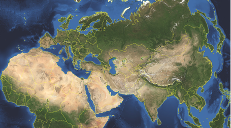
This visual essay explores the possibility of delineating two different types of routes, 'pathways' and 'highways', and the extent to which archaeology can help to analyse them. The technologies of cost-raster GIS analysis are introduced and applied to two case studies in Eastern Anatolia and Western Central Asia, c. 3000-1000 BC. It is to be hoped that the highlighted patterns, combined with a knowledge of contemporary material transformations, will provide insights into the processes of socio-economic change across these reconstructed networks of interaction.
Research carried out in Turkey over the last few decades seems to indicate that the Early Bronze Age in west and central Anatolia was a period in which new socio-political structures emerged whose mature development is reflected in the territorial entities of the Old Assyrian period. From the second half of the third millennium, we have evidence of social stratification both at the intra-site and inter-site level, accompanied by a wealth of prestige goods and public structures displayed in settlement and funerary contexts. This phenomenon is also paralleled by the rapid growth of long-distance relations both within Anatolia and with surrounding regions, at least partially triggered by the rise in metal demand of local and foreign elites.
Trading connections and routes play a very important part in the development (or re-development) of urban centres in the Middle Bronze Age Levant. This is particularly clear in the regions of Cilicia and the Amuq Plain in the Hatay, in the north-east corner of the East Mediterranean, where at the beginning of the Middle Bronze Age we have evidence of large-scale public buildings and fortification systems which represent the revival of complex political and economic structures, following a collapse at the end of the Early Bronze Age. A key role in this is played by harbour towns on the Cilician and Levantine coasts, which have an important part in the articulation and exploitation of maritime and inland routes connecting different zones and their resources. This in turn leads, by the beginning of the Late Bronze Age, to the formation of a symbiotic network of semi-dependent kingdoms which link these different inland and coastal zones in a single interactive socio-economic system.
Little was known of the remarkable heritage of the Silk Road until explorers and archaeologists of the early twentieth century uncovered the ruins of ancient cities in the desert sands, revealing astonishing sculptures, murals and manuscripts. One of the most notable discoveries was the Buddhist cave library near the oasis town of Dunhuang on the edge of the Gobi desert in western China. The cave had been sealed and hidden at the end of the first millennium AD and only re-discovered in 1900. Forty thousand manuscripts, paintings and printed documents on paper and silk were found in the cave itself. Tens of thousands more items were excavated from other Silk Road archaeological sites. These unique items have fascinating stories to tell of life on this great trade route from 100 BC to AD 1400. Yet most were dispersed to institutions worldwide in the early 1900s, making access difficult. The size and scope of the collections, as well as their fragility and limited access, has meant that, while they constitute a primary research resource for the history and literature of the region, many of the manuscripts in particular have yet to be studied in detail. The International Dunhuang Project aims to reunite this material by making it freely available online. One part of this project includes the mapping of archaeological sites, and the digitisation of data from archaeological data collected by Aurel Stein and other researchers, using tools such as Google Earth to help users to better understand the history of the Tarim Basin and its cultures.
New research is currently being carried out in order to collect supplementary data, both historical and archaeological, on the road networks of Medieval Bilād al-Šām and their related facilities. Supported by the material evidence of caravanserais, the aim of the research is to propose a reconstruction and a preliminary analysis of the region's communication axis from the beginning of the Ayyubid period till the end of the Mamluk. The preliminary character of the reflections offered in this article will hopefully be pursued more thoroughly in the completion of a larger project now in its final phase.
In our imagination of the 'Silk Routes', we envisage travellers, traders and intellectuals traversing vast continents for the purpose of exchanging rare and precious items. The archaeological study of these routes has usually focused on transmitted artefacts and ideas, as opposed to the means and methods by which they were carried. The resultant void of knowledge concerning the infrastructure of the Silk Roads, and the nature of the settlements that shaped and were shaped by them, presents a challenge to archaeologists from both a methodological and theoretical perspective.
 Occasional Papers (2009-)
 Site Visualisations