ArchAtlas journal articles which mention this site
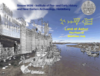
Mat Ashur - Land of Ashur

This paper gives an introduction to the archaeology of the Assyrian heartland where only a limited investigation outside of the big centres has taken place in the field. With methods of landscape archaeology and remote sensing techniques it is possible to survey a wide area and integrate detected landscape features into an historical framework and social and chronological contexts.
Tellspotting

How do we know where sites are? In the arc from south-east Europe to north-west India, early farming sites often form prominent mounds (known from the Arabic term as tell settlements). Such sites were often occupied over many millennia, and some of them grew into major cities during the Bronze Age; though thereafter settlement tended to shift to new locations away from the mounds. These early settlement-mounds form characteristic features of the landscape, and in fact are visible from space. Release of data from the Shuttle Radar Topography Mission in 2000 has provided the opportunity to identify the positions of many known archaeological sites of this type and to recognise others. Tellspotting is now not only an agreeable hobby, but has a high-tech methodology: an invaluable tool in reconstructing settlement-history and a means of inventorizing these outstanding sources of archaeological information.
 Occasional Papers (2009-)
 Site Visualisations