Important news about the threat to the Dept of Archaeology at the University of Sheffield... Read more...

Geospatial Analysis of Aguadas
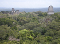
Water has been a principal concern for Maya people inhabiting much of the Yucatan Peninsula for millennia. As a result, studies of water management in the Maya region contribute significantly to our understanding of ancient Maya civilization and its environmental adaptations. Aguadas, water storage ponds of varying size, have been an understudied aspect of Maya water management systems. Recognizing the origins and functions of aguadas provides a more complete picture of ancient Maya water management strategies. In this study, we analyze aguadas geovisually and geospatially in the southern Maya lowlands.

Trade networks in the Karakum

In our imagination of the 'Silk Routes', we envisage travellers, traders and intellectuals traversing vast continents for the purpose of exchanging rare and precious items. The archaeological study of these routes has usually focused on transmitted artefacts and ideas, as opposed to the means and methods by which they were carried. The resultant void of knowledge concerning the infrastructure of the Silk Roads, and the nature of the settlements that shaped and were shaped by them, presents a challenge to archaeologists from both a methodological and theoretical perspective.

Levant Harbour Towns in the Middle Bronze Age

Trading connections and routes play a very important part in the development (or re-development) of urban centres in the Middle Bronze Age Levant. This is particularly clear in the regions of Cilicia and the Amuq Plain in the Hatay, in the north-east corner of the East Mediterranean, where at the beginning of the Middle Bronze Age we have evidence of large-scale public buildings and fortification systems which represent the revival of complex political and economic structures, following a collapse at the end of the Early Bronze Age. A key role in this is played by harbour towns on the Cilician and Levantine coasts, which have an important part in the articulation and exploitation of maritime and inland routes connecting different zones and their resources. This in turn leads, by the beginning of the Late Bronze Age, to the formation of a symbiotic network of semi-dependent kingdoms which link these different inland and coastal zones in a single interactive socio-economic system.

Unscrambling the 'Uplands'

This presentation forms part of a a collaborative British-Syrian project called Settlement and Landscape Development in the Homs Region, Syria, that seeks to compare human activity in adjacent but contrasting landscapes in a typical part of western Syria. In this case we focus on an upland landscape, where stone architecture is the expectation. In the traditional literature, most discussion of such areas has concentrated upon the evidence for activity of Graeco-Roman date - the Dead Cities of the Limestone Massif on north-western Syria are an excellent example. However, we have very little knowledge of the evidence for earlier periods. This is, we suspect, because we have little idea of what we should be looking for.

Mat Ashur - Land of Ashur

This paper gives an introduction to the archaeology of the Assyrian heartland where only a limited investigation outside of the big centres has taken place in the field. With methods of landscape archaeology and remote sensing techniques it is possible to survey a wide area and integrate detected landscape features into an historical framework and social and chronological contexts.

Quantitative approaches to the remote sensing of ancient settlements

Tells, the characteristic settlement mounds of the Near East, are visible remains of the first human settlement system. Often piled up to considerable heights by the debris of millennia of settlement activity, they provide characteristic physical signatures, such as specific elevation profiles or soil changes, which – potentially – can be detected in data available from space-borne sensors. Using methods from pattern recognition and statistical learning, we systematically evaluated digital elevation models and multispectral imagery to provide means for a machine based detection and mapping of these archaeologically relevant settlement sites.

Contagious Processes

Archaeologists have long recognised (though in practice tend to forget) the degree to which developments in one part of the world were affected by things happening elsewhere. These animated maps of the spread of farming and of urbanism are intended to show a fundamental aspect of long-term human history: the underlying patterns of concentric expansion which have characterised cultural change in the Holocene.

Environmental Change: The evolution of Mesopotamia

The areas that were occupied by early farmers and town-dwellers were often very different from the landscapes that can be seen in the same areas today. Some of the most important changes took place in the great river basins where urban civilisation first emerged. Southern Mesopotamia (Iraq), the land of the two rivers, has been transformed over the last six thousand years by the changing relationships between rivers, land and sea. Although the pattern has not yet been reconstructed in detail, satellite imagery can be used to outline the major processes of change, and to visualise what an extraordinary landscape this was at the time of the first cities.