ArchAtlas journal articles which mention this site
Exploring Routes and Plains in Southwest Iran

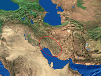
Satellite imaging has given a new dimension to fieldwork in the varied terrain of Southwestern Iran, where the Zagros mountains separate the Mesopotamian lowlands from highland Iran, and whose successive ridges enclose fertile intermontane valleys. These fertile enclaves were often settled as early as the Neolithic, and have a continuous history of occupation down to the present day. They gained a historical importance as stepping stones on routes through the mountains (both for transhumance and trade), and as nodal points in the formation of political units.
 Occasional Papers (2009-)
 Site Visualisations