ArchAtlas journal articles which mention this site
Ancient Near Eastern Route Systems: From the Ground Up

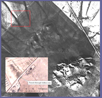
A particularly common trace of ancient route systems on the ground is the 'hollow way'. In the Middle East hollow ways, like their counterparts in the UK and Europe, appear as long, usually straight valleys. This paper examines the traces of these ancient route systems in the Ancient Near East according to their pattern, processes of formation, parallels elsewhere, and their function.
Agricultural and Pastoral Landscapes in the Near East

The Near East presents particular challenges to the study of past landscapes. Remote sensing has been a part of archaeology for a century, and aerial photographic coverage is now the ideal and standard for field survey basemaps. Such coverge, however, is not globally available. In the modern Middle East, for example, easy access to aerial photography is often impossible to obtain. As a result, archaeologists have turned to satellite imagery. Unfortunately, the resolution of space-based imaging systems such as Landsat and SPOT is often too coarse for archaeological features. To some extent, this issue has been solved by the availability of commercial high-resolution imagery. However, such imagery is expensive and documents the modern developed landscape. Over the last decade, Near Eastern archaeologists employed a new satellite resource that resolves many of these issues: the declassified CORONA intelligence program.
Quantitative approaches to the remote sensing of ancient settlements

Tells, the characteristic settlement mounds of the Near East, are visible remains of the first human settlement system. Often piled up to considerable heights by the debris of millennia of settlement activity, they provide characteristic physical signatures, such as specific elevation profiles or soil changes, which – potentially – can be detected in data available from space-borne sensors. Using methods from pattern recognition and statistical learning, we systematically evaluated digital elevation models and multispectral imagery to provide means for a machine based detection and mapping of these archaeologically relevant settlement sites.
Tellspotting

How do we know where sites are? In the arc from south-east Europe to north-west India, early farming sites often form prominent mounds (known from the Arabic term as tell settlements). Such sites were often occupied over many millennia, and some of them grew into major cities during the Bronze Age; though thereafter settlement tended to shift to new locations away from the mounds. These early settlement-mounds form characteristic features of the landscape, and in fact are visible from space. Release of data from the Shuttle Radar Topography Mission in 2000 has provided the opportunity to identify the positions of many known archaeological sites of this type and to recognise others. Tellspotting is now not only an agreeable hobby, but has a high-tech methodology: an invaluable tool in reconstructing settlement-history and a means of inventorizing these outstanding sources of archaeological information.
Virtual Survey: a semi-automated tellspotting algorithm

Following the observation that prehistoric and early historic settlement-mounds (tell settlements) in parts of the Near and Middle East can be recognized in the SRTM 90m terrain model (Sherratt, Antiquity 2004) an algorithm has been developed to do this automatically, using current techniques of computer modeling.
 Occasional Papers (2009-)
 Site Visualisations