 Occasional Papers (2009-)
 Site Visualisations
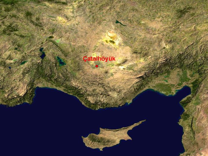
NASA Blue Marble true-colour global imagery [1km resolution]
A wet spot in a dry basin: the exceptional site of Çatalhöyük occupies the largest alluvial fan in the Konya plain, its well-watered surroundings contrasting with the general aridity of the plateau of south-central Turkey. The plain is rimmed by the forested Taurus mountains to the south, separating it from the coast. Large lakes occupy inter-montane basins to the west, offering a route to the west coast and the Aegean.
NOAA National Data Centre, NGDC, Digital elevation model at 1km resolution, tinted by altitude.
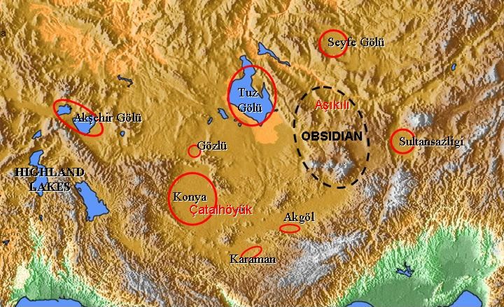
The internal drainage basins of the plateau were occupied by large lakes during the last glaciation, of which the lowland Salt Lake (Tuz Gölü) and the highland lakes (some overspilling into the plain) survive to today.The Cappadocian obsidian sources around Hasan Dağ were an important resource in Mesolithic and Neolithic times, and the site of Aşıklıhöyük preceded Çatalhöyük as an important distribution-centre for this material
Landsat image, 30m resolution, circa 1990, with Band 7
displayed as red, Band 4 as green and Band 2 as blue.
Landsat TM imagery provided by NASA.
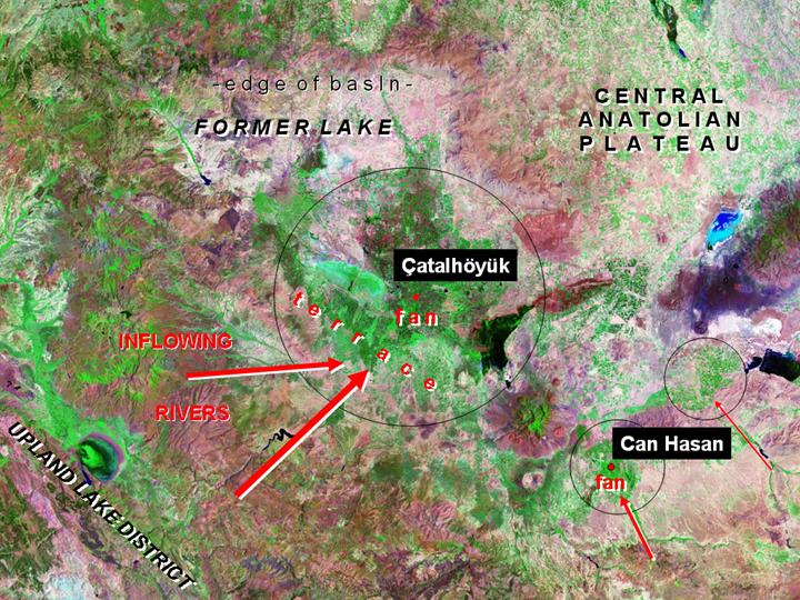
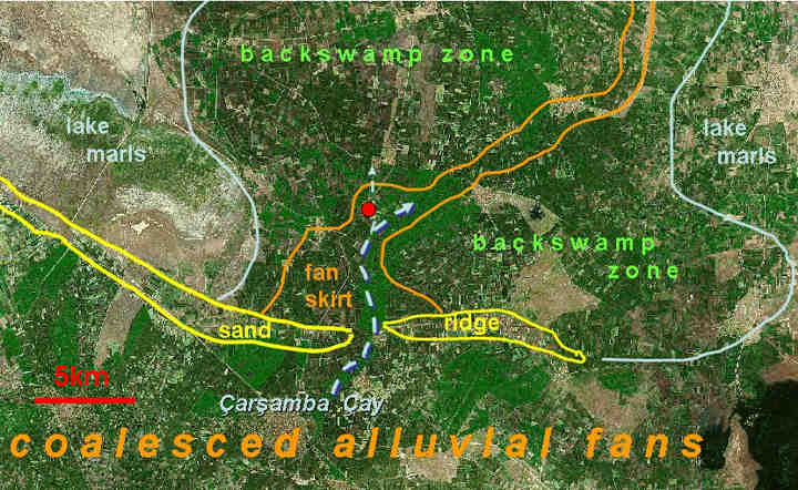
Rivers flowing from the highland lake district have created a major fan-complex, partly constrained by sand-bars around the shore of the former lake, whose marl-covered basin is dry and infertile away from the well watered fan. Small fans from streams entering the lowlands from the Taurus mountains to the south sustained smaller sites during the Neolithic and Chalcolithic periods. The terraces were more extensively occupied in the Bronze Age, when a major route-way ran around the southern edge of the basin. The volcanic mountain of Kara Dağ rises as a cone, between Çatal and Can Hasan.
Landsat TM imagery provided by NASA.
Part of a geomorphological map by Catherine Kuzucuoglu, superimposed on 30m Landsat imagery, clearly shows the shoreline of the former lake and the bodies of sediment accumulating around the edge of the basin, along with the small lakes and seasonally flooded backswamp areas around the edges of the fans.
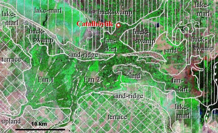
Landsat TM imagery provided by NASA.
Part of a soil-map by Driessen and de Meester (reproduced from Sherratt 1973), overlain on 30m Landsat imagery, graphically shows the unique position of Çatalhöyük on the levee of the Çarşamba Çay where it has broken through a sand-ridge representing a Pleistocene shoreline. Surrounding areas of lake-marl and backswamp are indicated.
Landsat 7 imagery provided by NASA
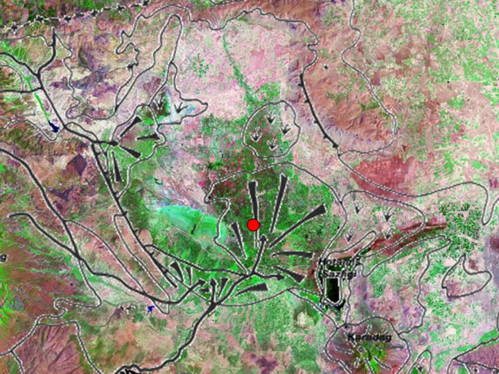
Lansat 7 image with geomorphological elements outlined, showing the position of Çatalhöyük on a principal channel at the edge of the fan. The long extension on the north-west indicates the recent principal channel.
Referenced sites
| Site Name | Country | Latitude | Longitude | OpenAtlasID |
|---|---|---|---|---|
| Çatalhöyük | tr | 37.666454 | 32.828349 | tr/catalhoyuk |