 Occasional Papers (2009-)
 Site Visualisations
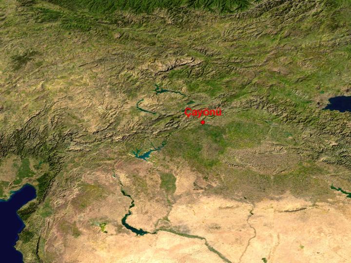
NASA Blue Marble true-colour global imagery [1km resolution]
The location of Çayönü, in a fertile plain between the Upper Tigris and the intermontane basins beyond the Taurus, linked both to east and west.
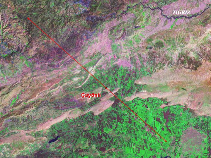
Landsat image, 30m resolution, circa 1990, with Band 7 displayed as red, Band 4 as green and Band 2 as blue.
Landsat TM imagery provided by NASA.
The axis marked by a red line, followed by the Assyrian and Roman road systems, passes through Ergani basin, in which the site is located.
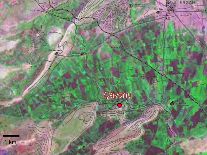
Landsat TM imagery provided by NASA.
A location-map of the site (after Özdoğan), overlain on 30m Landsat imagery. The site itself overlooks the floodplain of a stream descending from the mountains. A nearby railway-line emphasises its location on a natural routeway.
Referenced sites
| Site Name | Country | Latitude | Longitude | OpenAtlasID |
|---|---|---|---|---|
| Çayönü | tr | 38.216329 | 39.726509 | tr/cayonu |