 Occasional Papers (2009-)
 Site Visualisations
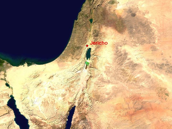
NASA Blue Marble true-colour global imagery [1km resolution]
Jericho occupies an oasis in the dry rift-valley of the River Jordan, north of the Dead Sea.
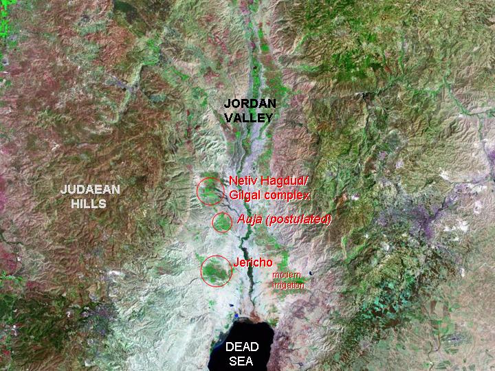
Landsat image, 30m resolution, circa 1990, with Band 7 displayed as red, Band 4 as green and Band 2 as blue.
Landsat TM imagery provided by NASA.
The Jordan rift forms a rain-shadow, between the better-watered highlands on either side. Its eastern side is punctuated by springs fed by aquifers in the Judaean hills, which provide a chain of oases along the valley. These were occupied by farmers from the very beginning of the Holocene.
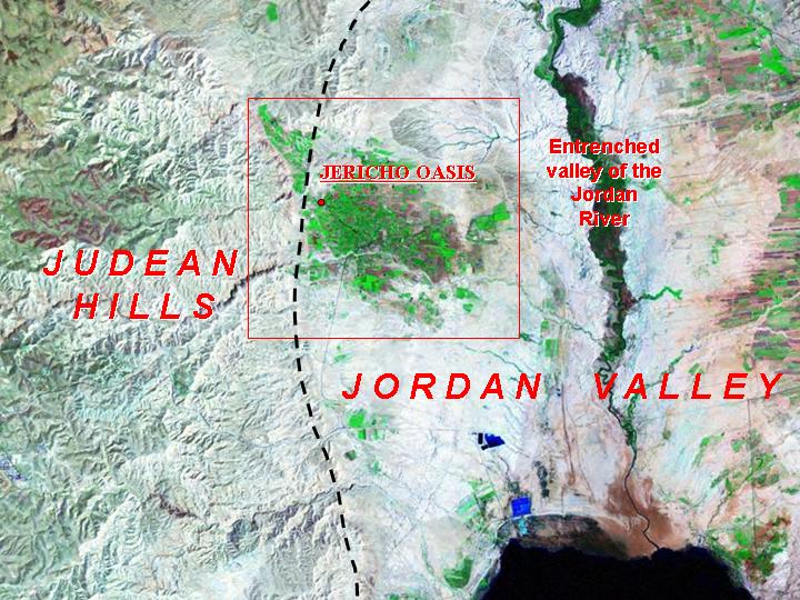
Landsat TM imagery provided by NASA.
Now extended by pump-irrigation, the well-watered area of the Jericho oasis contrasts with the dry bed of the rift, floored with eroded lake-deposits from the last glacial period (Lisan marls). The river-valley itself was entrenched during a phase of downcutting in the Chalcolithic period. On the eastern bank, an artificial canal of recent contruction carries water parallel to the river to irrigate extensive areas. See the tell (rectangular area) from a high resolution satellite image in a new web-page.
Landsat imagery provided by NASA.
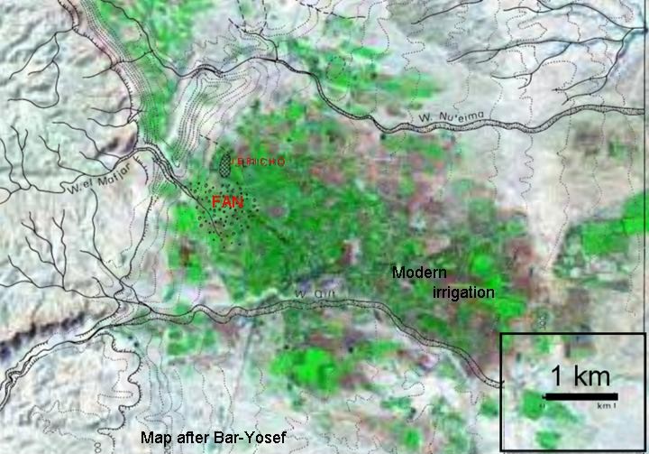
A location-map of the site (after Bar-Yosef) overlain on 30m Landsat imagery shows the site, with its own copious spring the Ain es-Sultan, adjacent to well-watered soils on the alluvial fan which accumulated in the Late Glacial and Early Holocene periods.
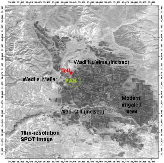
SPOT panchromatic image, orthorectified, 10m resolution, 1992-4.
10m SPOT imagery shows the fan of the Wadi el Mafjar between incised wadis, less suitable for simple cultivation, to north and south.
Referenced sites
| Site Name | Country | Latitude | Longitude | OpenAtlasID |
|---|---|---|---|---|
| Jericho | il | 31.87055 | 35.44401 | il/jericho |