 Occasional Papers (2009-)
 Site Visualisations
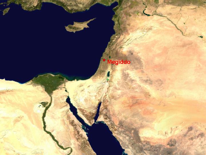
NASA Blue Marble true-colour global imagery [1km resolution]
Megiddo was a major stronghold in the second and first millennia, at the crossing-point of two routes. The first was the major north-south route (the via maris or way of the sea) up the coast from Egypt and across to the Upper Jordan (Sea of Galilee and lake Huleh), giving onward access to Syria and the Lebanon. The second was the route from the important coastal ports around Mount Carmel, by way of the Jezreel valley, to the site of Beth Shan in the Jordan valley. It was sustained by the fertile soils of the Jezreel valley itself.
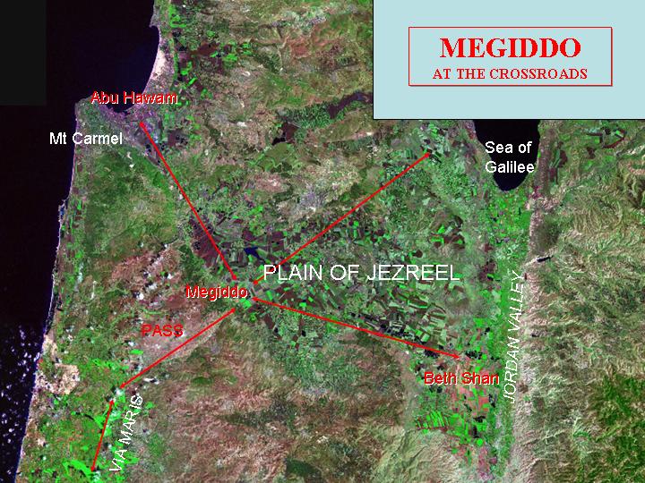
Landsat image, circa 1990, with Band 7 displayed as red, Band 4 as green and Band 2 as blue.
Landsat TM imagery provided by NASA.
Megiddo lies at the head of a route through the hills, separating the coastal plain from the Jezreel valley.
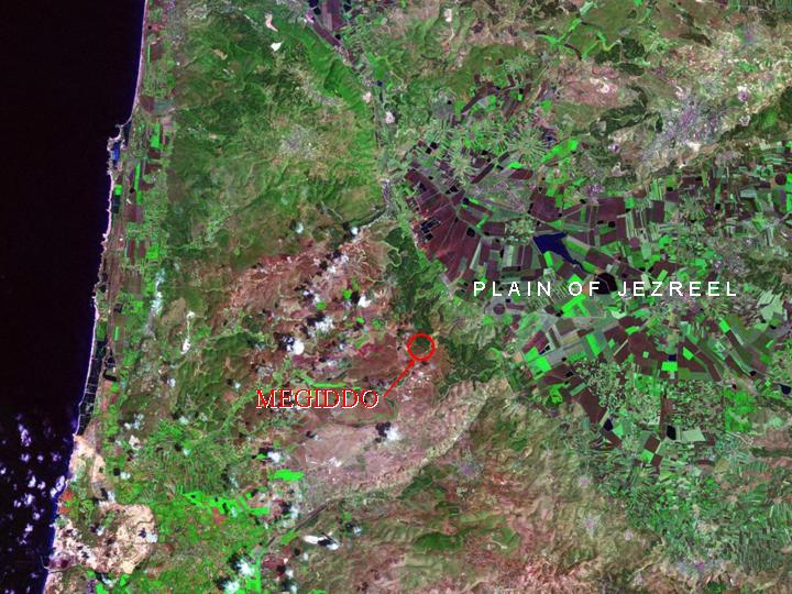
Landsat TM imagery provided by NASA.
It occupies a prominent elevation overlooking the plain and dominating both the narrow pass and the route along the edge of the plain.
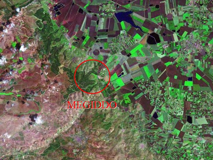
Landsat TM imagery provided by NASA.
Armageddon: the site of Megiddo itself was a spectacular fortification, incorporating the latest advances in military architecture. The plain in front of it, the Plain of Megiddo, (Har Megiddon) was foreseen in the Book of Revelation as the site of a great battle on the Day of Judgement – hence the name, Armageddon.
Referenced sites
| Site Name | Country | Latitude | Longitude | OpenAtlasID |
|---|---|---|---|---|
| Megiddo | il | 32.577367 | 35.169761 | il/megiddo |