 Occasional Papers (2009-)
 Site Visualisations
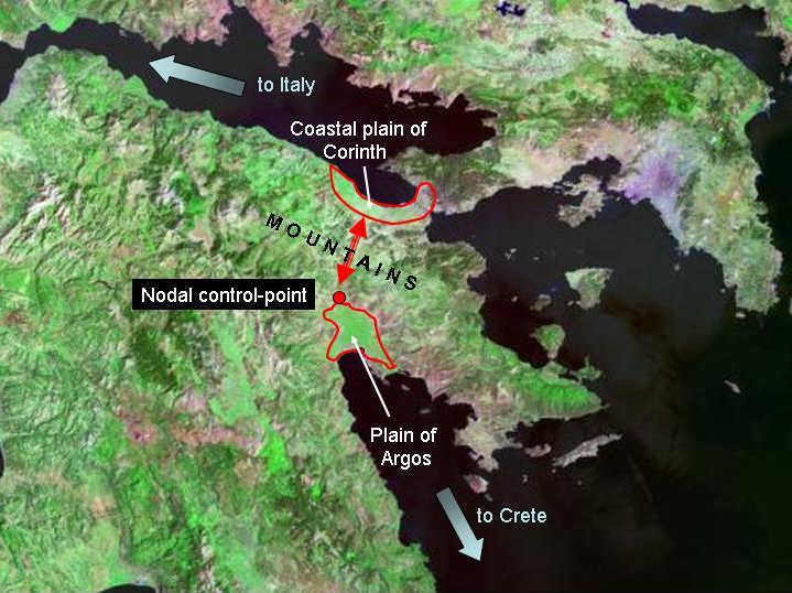
Landsat 7 imagery provided by NASA.
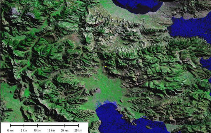
The importance of Mycenae stems from its position on the trans-isthmian route between the Aegean and Italy, via the Gulf of Corinth. (See Portages 33-5).
Landsat 7 imagery provided by NASA.
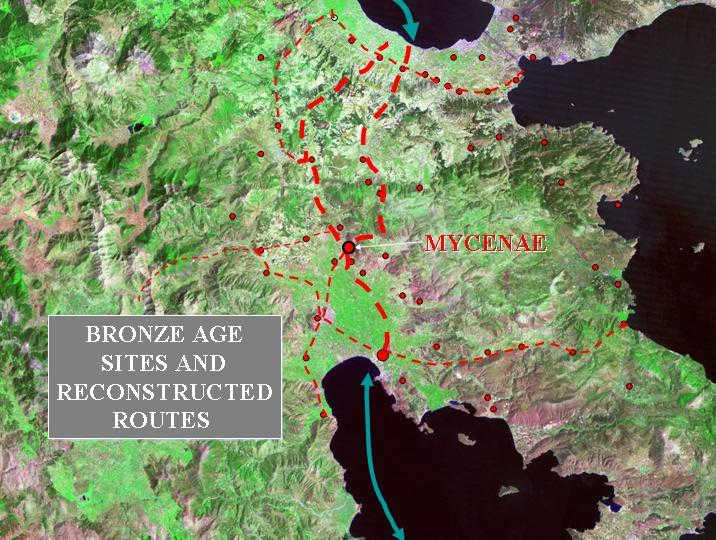
The distribution of Late Bronze Age sites, and some indications of roads and bridges, allow the routes to be tentatively reconstructed.
Landsat 7 imagery provided by NASA.
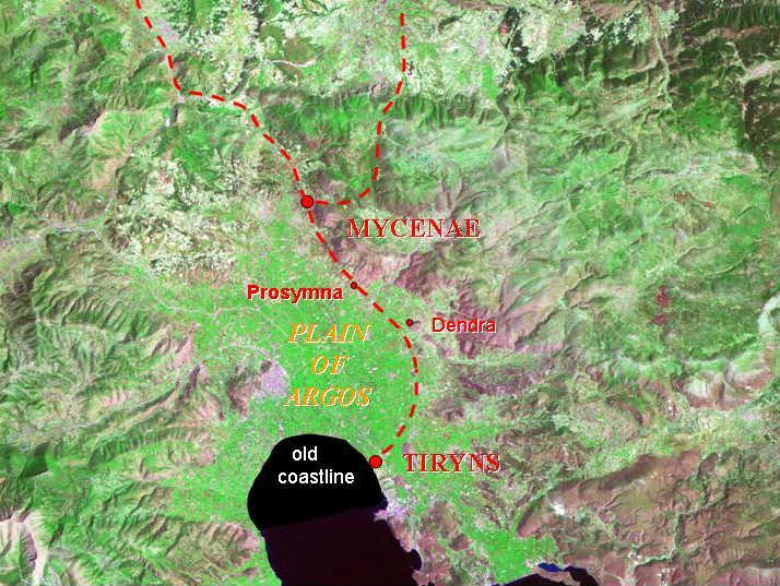
Mycenae is situated at the northern end of the Plain of Argos, controlling the constriction point. Tiryns lay on the coast, and two other fortified centres mark the route along the eastern edge of the plain, Midea (Dendra) and Prosymna.
Landsat 7 imagery provided by NASA.
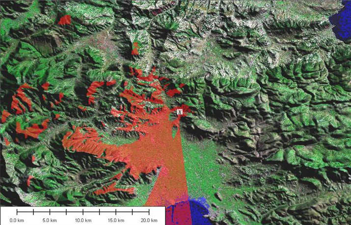
On a clear day, the site gives a view of the whole of the western part of the plain, as demonstrated by this viewshed (red overlay) from the acropolis of Mycenae. The viewshed (a word invented by analogy with 'watershed') is the area visible from a particular point, as calculated from the terrain model – in this case, the 90m SRTM data.
Landsat 7 imagery provided by NASA.
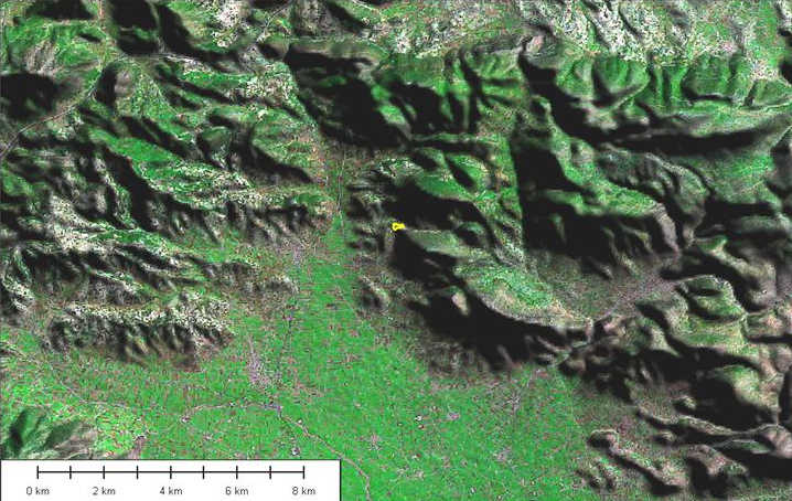
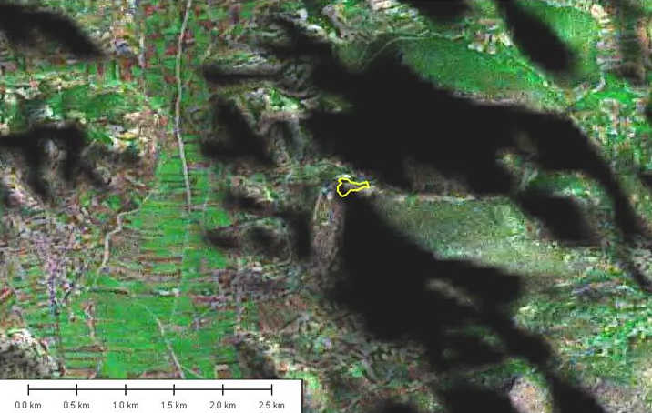
A more detailed representation of the topography emphasizes the role of Mycenae as a castle or hillfort dominating a critical pass through the hills. The yellow line (here only visible as a dot) indicates the actual area of the site within the walls.
Landsat 7 imagery provided by NASA.
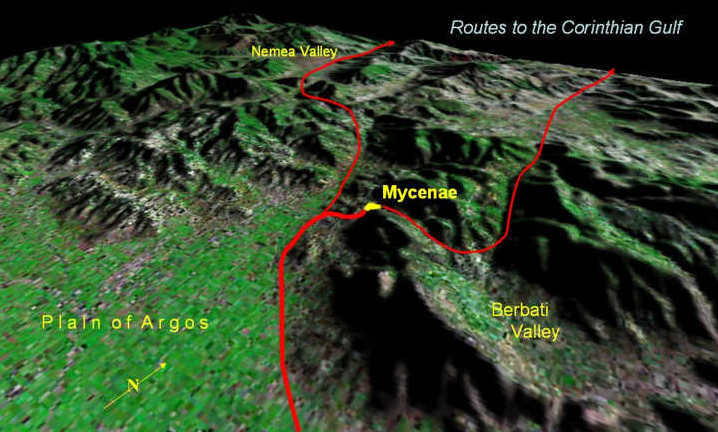
The site is positioned at the junction of the main north-south route with the pass westward to the Berbati valley (where pottery production took place in Mycenaean times).
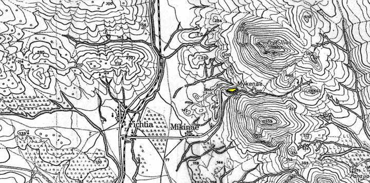
The site sits between the impressive peaks of Profitis Ilias (to the NE) and Zara (to the SE), on a spur of land which projects westward into the valley but quickly turns south. This spur is not continuous, however, because it is cut by a ravine (not evident at the resolution of the satellite imagery, but visible on this map), which channels the seasonal stream which emerges from the gap between the mountains, and leads it southwards, between the mountain and the elongated spur. This ravine provides a steep boundary to the eastern side of the site. The land also slopes away to the north, but an exit on the western side (via the famous Lion Gate) gives access to the flatter land on top of the spur. The road follows the terrain, turning south and running parallel to the seasonal stream-course (after Lehmann). Compare this map with the following satellite image, for approximately the same area.
Landsat 7 imagery provided by NASA.
Topography thus provides a natural acropolis, strategically positioned and overlooking the valley, providing a defensible location in a critical position. The reasons for the importance of the site thus exist simultaneously on several scales, including (1) its position within networks of movement, (2) its location in relation to its sustaining area, and (3) the defensive requirements of the immediate site. The topographic setting of the site can best be appreciated in 3D using VRML (see link at bottom of page).
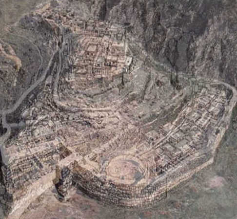
A partial reconstruction of Mycenae (set in real topography), looking east, towards the mountain slopes (though separated from them by the narrow ravine). The main entrance (through the Lion Gate) is in the left foreground, and Grave-circle A is prominent within the re-modelled fortifications in the centre foreground. The palatial complex occupies the highest ground in the centre of the site. Comfort took second place to defensibility, and a dominating position.
Landsat 7 imagery provided by NASA.
This north-westward-looking view emphasises the position of Mycenae at a junction point of routes, but also dominating the northern margin of the plain of Argos. It uses Landsat 7 imagery draped on the SRTM terrain model to provide a dramatic demonstration of its setting in the terrain.
Referenced sites
| Site Name | Country | Latitude | Longitude | OpenAtlasID |
|---|---|---|---|---|
| Mycenae | gr | 37.730506 | 22.756501 | gr/mycenae |