 Occasional Papers (2009-)
 Site Visualisations
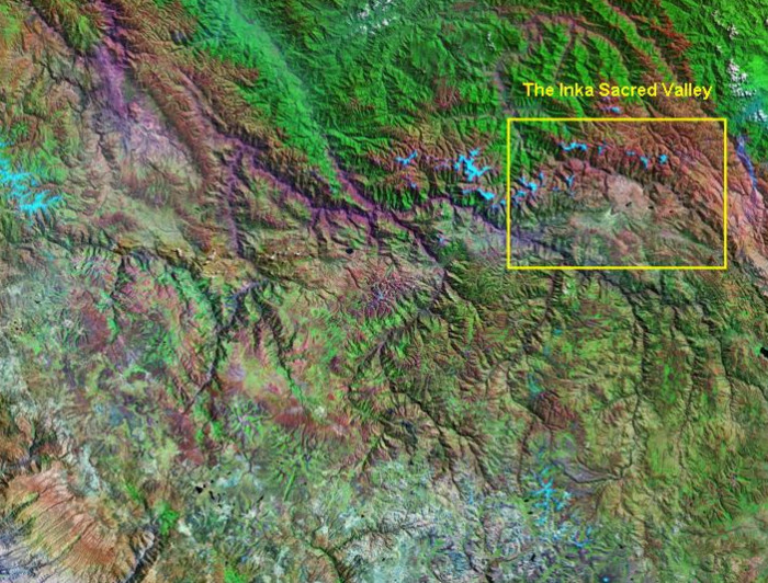
Landsat TM image, 30m resolution, circa 1990, with Band 7 displayed as red, Band 4 as green and Band 2 as blue.
Landsat TM imagery provided by NASA.
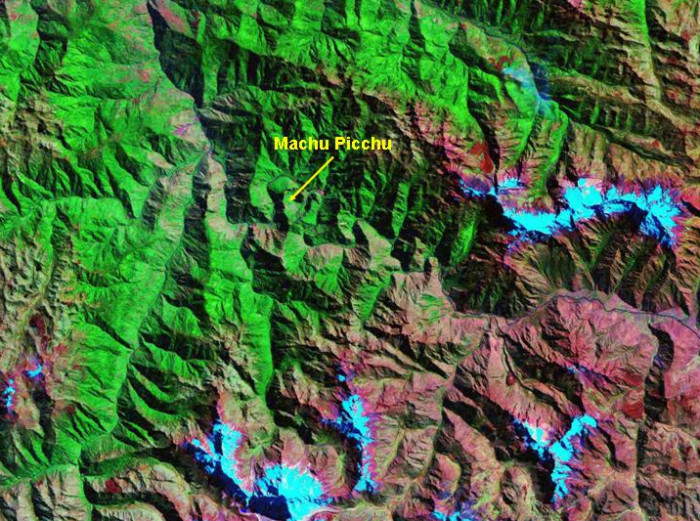
Towards the northern edge of the Altiplano, just touched by tropical rainfall and drained by the headwaters of the Amazon, is the Sacred valley of the Inkas with the imperial capital at Cuzco and the famous site of Machu Picchu.
Landsat TM imagery provided by NASA.
The "Sacred Valley" consists of two parallel valleys, that of the Urubamba (drained by the homonymous river) to the north and a valley to the south drained by two rivers: the Huatanay to the east, and the Anta (a tributary of the Urubamba River) to the west, almost linking the two valleys.
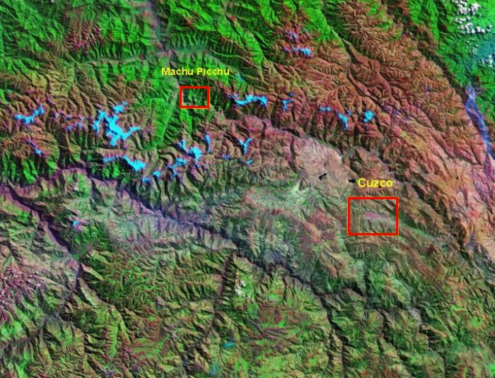
Landsat TM image, 30m resolution, circa 1990, with Band 7 displayed as red, Band 4 as green and Band 2 as blue.
Landsat TM imagery provided by NASA.
Cuzco occupies a relatively narrow east-west valley, constrained by hills on either side.
Landsat TM imagery provided by NASA.
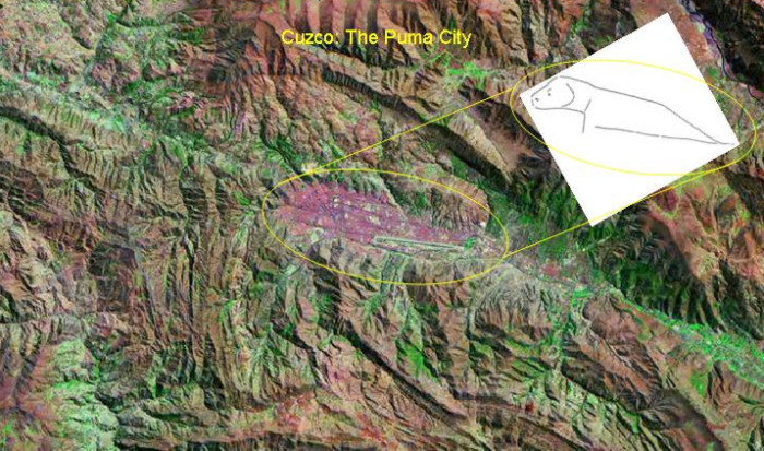
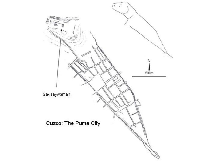
With the hilltop fortress of Saqsaywaman, the layout of Cuzco resembles a puma.
The Inkas: last stage of stone masonry development in the Andes, Francesco Menotti (1998)
The street-plan of Cuzco shows its puma-like layout, with its fortified 'head' containing the military and administrative nerve-centre (Menotti 1998)
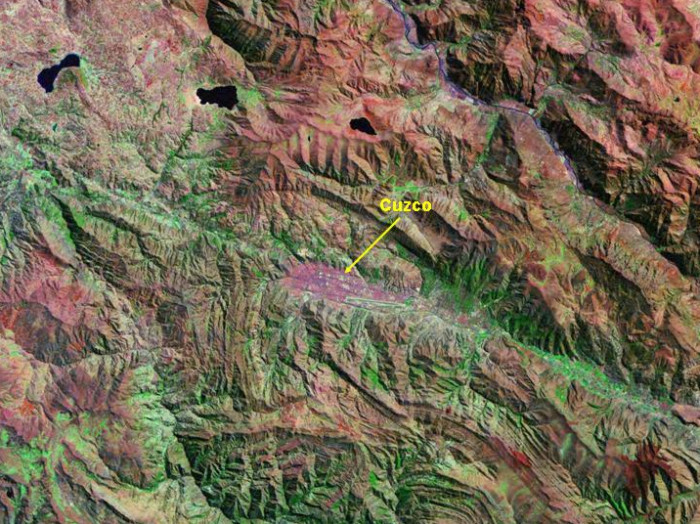
Landsat TM image, 30m resolution, circa 1990, with Band 7 displayed as red, Band 4 as green and Band 2 as blue.
Landsat TM imagery provided by NASA.
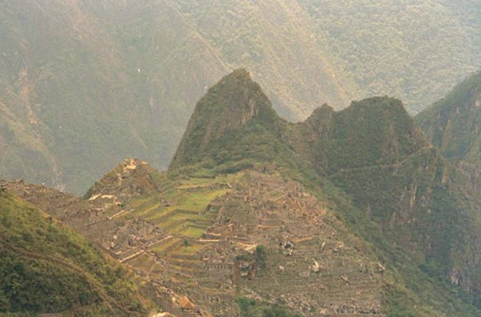
Machu Picchu is located at the top of a peak within an incised bend of the river Urubamba, dominating this twisting artery of contact with the lowland world.
NASA/GSFC/METI/ERSDAC/JAROS, and U.S./Japan ASTER Science Team; Photographs
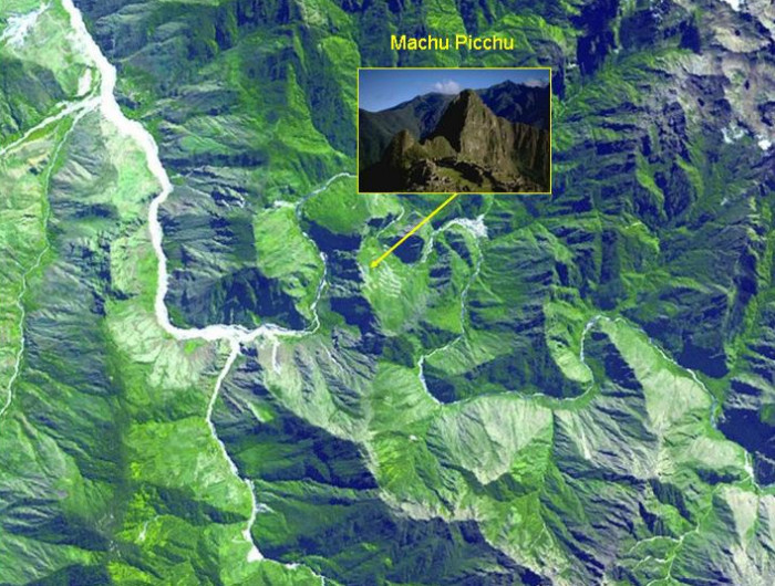
The location of Machu Picchu (view, inset) and its relation to the river Urubamba is clearly visible in this ASTER image. Click here for an external link to a 1m resolution QuickBird image of Machu Picchu.
Francesco Menotti 1995
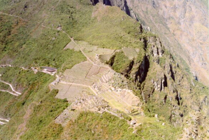
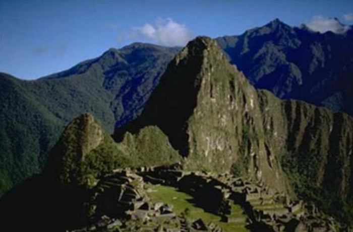
Machu Picchu photographed from the top of the Huayna Picchu.
Francesco Menotti 1995
Machu Picchu photographed from the Inka trail before entering the Citadel.
Francesco Menotti 1995
Machu Picchu photographed from the restored thatched house.
Referenced sites
| Site Name | Country | Latitude | Longitude | OpenAtlasID |
|---|---|---|---|---|
| Cuzco | pe | -13.522134 | -71.983346 | pe/cuzco |
| Machu Picchu | pe | -13.163344 | -72.546192 | pe/machu_picchu |