 Occasional Papers (2009-)
 Site Visualisations
SOUTH AMERICA FROM SPACE
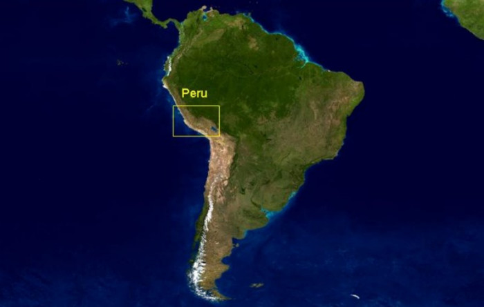
South America, showing the position of Peru on the Pacific coast, and close juxtaposition of ecological zones: littoral zone, dry coastal plain (with river-valleys), high mountains (with mountain valleys) and tropical rainforest behind. The boxed area of southern Peru includes the highland centres of Tiwanaku and Cuzco, and the coastal plain of Nazca.
Click on the box to access the region
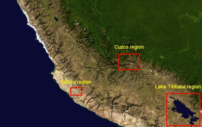
In southern Peru the mountain chain widens as the Cordillera Occidental diverges from the Cordillera Oriental to frame a high mountain area which flattens out to the south (the Altiplano). This upland area became increasingly important through time, culminating in the Inka Empire. On this image, fog shrouds areas of the coastal strip. The positions of the major highland capitals of Cuzco and Tiwanaku are shown, along with the coastal area of Nazca, where the rivers bring water to narrow tracts of an otherwise arid landscape.
CREDITS: Imagery provided by NASA (Earth Observatory - Blue Marble- 1km resolution)