 Occasional Papers (2009-)
 Site Visualisations
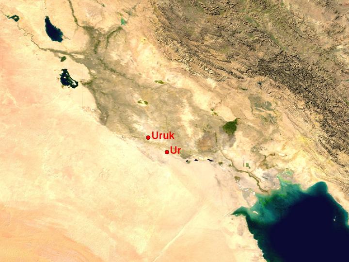
NASA Blue Marble true-colour global imagery [1km resolution]
In a landscape now radically different from that of the fourth and third millennia BC when the sites were occupied as major urban centres, Uruk and Ur are far from the present head of the Persian Gulf; but Ur was a sea-port and Uruk was situated on a major riverine artery.
Landsat image, 30m resolution, circa 1990, with Band 7 displayed as red, Band 4 as green and Band 2 as blue.
Landsat TM imagery provided by NASA.
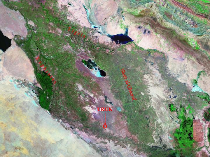
The now dry area between the present Euphrates and Shatt al-Gharraf was the crest of the alluvial fan created by the joint Euphrates and Tigris rivers, along which the major waterways ran in the fourth and third millennia BC. During the second and first millennia BC, these were successively displaced to the outer edges of the fan, and the present courses of these two rivers. The central area (which appears light purple in this image) was thus left as a 'fossil landscape', preserving the heartland of the worldís first urban cultures.
Landsat TM imagery provided by NASA.
The site of Uruk, just visible in this image, in the context of present-day watercourses, much altered from those of earlier millennia.
Landsat TM imagery provided by NASA.
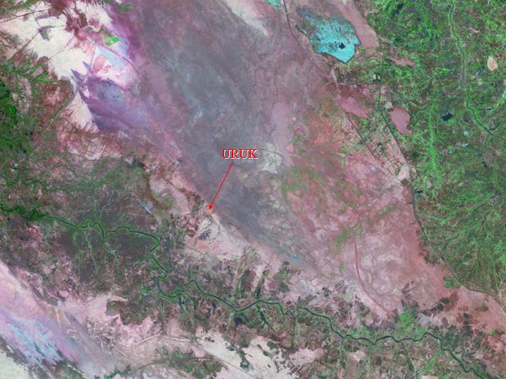
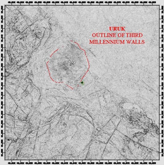
The outlines of the site, corresponding closely with the Early Dynastic walled city, are evident in this 30m resolution Landsat image.
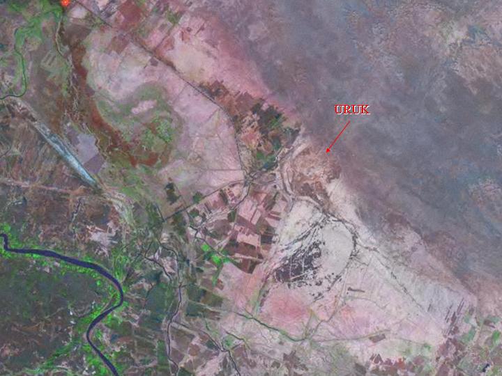
SPOT panchromatic image, orthorectified, 10m resolution, 1992-4.
A 30m SPOT image, analysed for linear features, provides the base on which to superimpose a site-plan.
Landsat TM imagery provided by NASA.
The area around Ur, originally close to the head of the Persian Gulf, is shown in this map illustrating the survey by Henry Wright (limits shown by a dashed line) with sites in relation to old watercourses, superimposed on a Landsat 30m image. The present course of the Euphrates, at the top of the image, is irrelevant to the period in question. The site of Eridu is on the far side of the Al Sulaybyat depression (the darker area in the bottom left of the image, off the edge of the picture).
Landsat TM imagery provided by NASA.
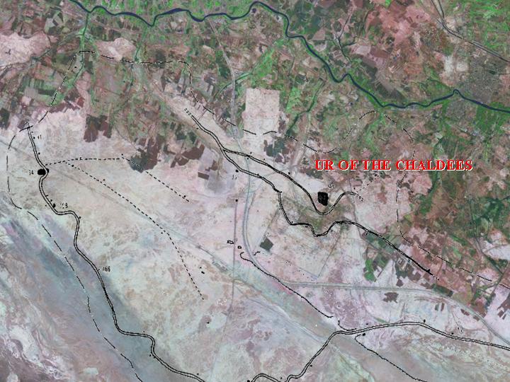
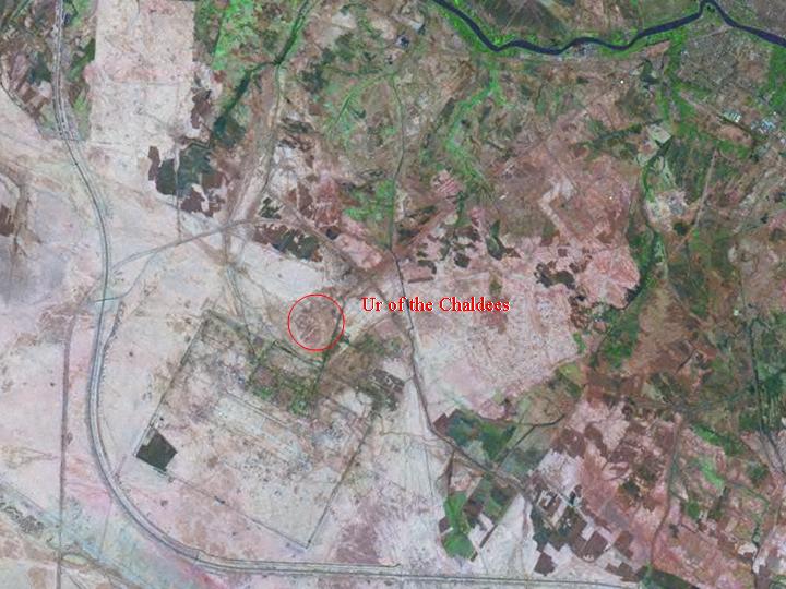
The present-day setting of Ur, next to the Tallil air-base (rectangle) and its supply-roads.