Occasional Papers (2009-)
 Site Visualisations
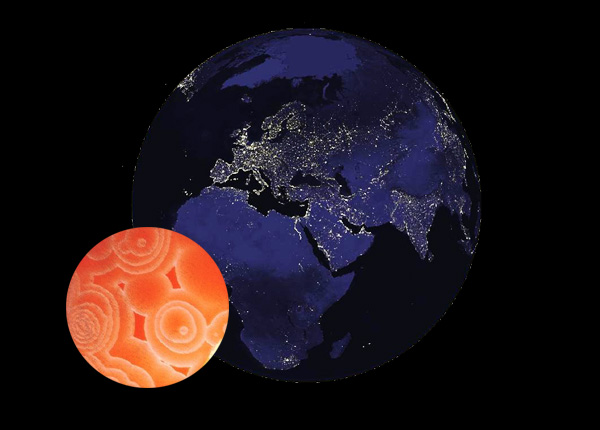
NASA's map of night-time lights, showing the stark differences in energy consumption in AD 2000, outlining the contemporary limits of a rapidly developing world. Inset: snapshot of a Zhabotinsky reaction, a chemical process which produces concentric patterns of development.
Concentric development
One of the things which makes the Holocene different from earlier phases of human existence is the extent to which human populations were affected by developments taking place in other parts of the world. During the last 10,000 years, half a dozen areas of the earth's surface exercised a critical influence – in different ways – on all the rest. Today's globalization is just the latest phase of this process.
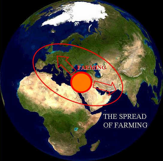
Recognition of this basic fact has been obscured by the abuse of this idea by diffusionists in the last century, and by writers who still uncritically attribute phenomena such as pyramids in different parts of the world to a common origin. Such ideas belong to quite a different realm of thought. Yet the progress of prehistoric archaeology throughout the world convincingly demonstrates the consistent growth and spread of certain patterns of human behaviour – the adoption of farming, and the expansion of urban networks – from limited areas of origin to large parts of the earth's surface. Farming (and, later, urban life) began independently just a few critical landscapes, and became widely adopted by their neighbours. While this was not the result of a single movement of peoples, or any simple process of colonization or cultural expansion, it is essential to recognize the clear overall pattern. This can best be described as a contagious process, initiated in a few nuclear areas, which gave rise to a traveling wave of population increase and cultural change, resulting in the emergence of more complex forms of social organization in the heartlands of the process.
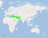
The simple animations which follow are intended to demonstrate the integrity and organic unity of this process. In the Old World, the two principal nuclear areas were the Near East (western Asia) and China. The Near East developed earlier and faster, so that it came to affect a larger proportion of the landmass, before the two macrosystems came increasingly into contact after 2000 BC, at first indirectly but from 500 BC more directly – both via the steppe region and through India. It was not, for the most part, a simple process of passive "diffusion" (though many key innovations spread outwards from the central regions); instead, the process of contagious spread gave rise to increasing regional diversity by reaction and local re-interpretation of the opportunities presented by this process. Nevertheless the underlying pattern is one of a consistent transformation of local cultures in the context of a wider unity – whether or not this was in any sense "beneficial" to the populations involved.
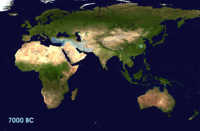
Representation of such large-scale phenomena is inevitably highly conventionalized and potentially misleading; but it is essential to grasp the spatial relationships between developments in different parts of the world, and to appreciate their inter-connectedness. These maps portray the overall pattern of expansion, treating large blocks of territory and respectively outlining the limits of the practice of farming (including livestock-rearing) and life in cities and towns. No account is taken of the great diversity of lifeways within these broad categories, or the intricate mosaics of co-existence which often characterized them. The aim is simply to demonstrate the consistent expansion of the limits to which these modes of life were confined, and to show the consistent increase in scale. The growth of urban life was accompanied by the development of trade routes, and this process can be followed in the Trade Routes section, which gives an equally conventionalized representation of the later parts of the process, in terms of networks rather than boundaries. Both ways of showing the pattern bring out complementary features of the overall structure.
These maps are exploratory and experimental, but they show a fundamental aspect of long-term human history: the increasing inter-relatedness of human populations in different parts of the globe, and some of the parallelisms in their historical experiences. Fortunately this has not led to dull uniformity, or to any overall diminution of cultural diversity – though it has given increasing opportunities for inequality, and for the domination of larger and larger areas by small segments of the human community.
SPREAD OF FARMING
(7000 BC - AD 500)
ANIMATIONS
On a Basic Map |
On a BlueMarble Satellite Image |
|
|
(Click on either the Thumbnail to see the animation) |
|