 Occasional Papers (2009-)
 Site Visualisations
Ghazni
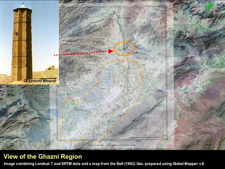
The Ghazni region was significant before the Ghaznavids as it lay along the major route between Kabul in the north and Kandahar in the south, and was also the point where several routes from South Asia (particularly those using the Kurram and Tochi passes) met the major north south route. The modern city is still best known for the pair of Ghaznavid period (11th - 12th century AD) minarets which are still standing (image from http://en.wikipedia.org/wiki/Image:Ghazni-Minaret.jpg Ghazni at Wikipedia). To the south of the modern town there is a large plain (delineated with the orange line), which Ball's map shows being almost covered with mounds. Whether or not any of these are actually archaeological is open to question, and only a handful of archaeological sites in this part of the plain are actually recorded in the gazetteer.
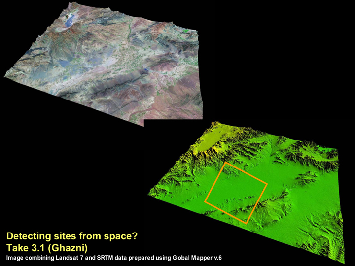
As can be seen from the Landsat 7 image at the top left, the plain area does not appear to be particularly well watered, and in fact today, Ghazni lies in an area that is prone to extreme drought. Although it is not possible to characterise the ancient climate of this region, a lack of water would undoubtedly have acted as a major constraint to human settlement on some areas of the plain. When we look at the SRTM data for this area at the bottom right, we can see that the plain itself is relatively flat and the mounds that were marked by Ball are particularly difficult to make out.
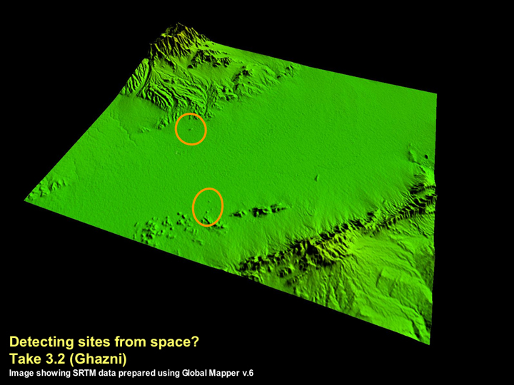
By looking at a close-up of the area within the square shown on the previous image, it is possible to make out a number of visible 'bumps' that may indicate the existence of archaeological mounds in parts of the plain. This is a far more encouraging result than those obtained from the preliminary look at Jalalabad and Kabul, and may be a product of the slightly flatter topography of this area. Only an assessment of other types of satellite imagery such as Aster or Corona will enable more specific identifications.
◄ Return to Remote Sensing in Inaccessible Lands