 Occasional Papers (2009-)
 Site Visualisations
Jalalabad
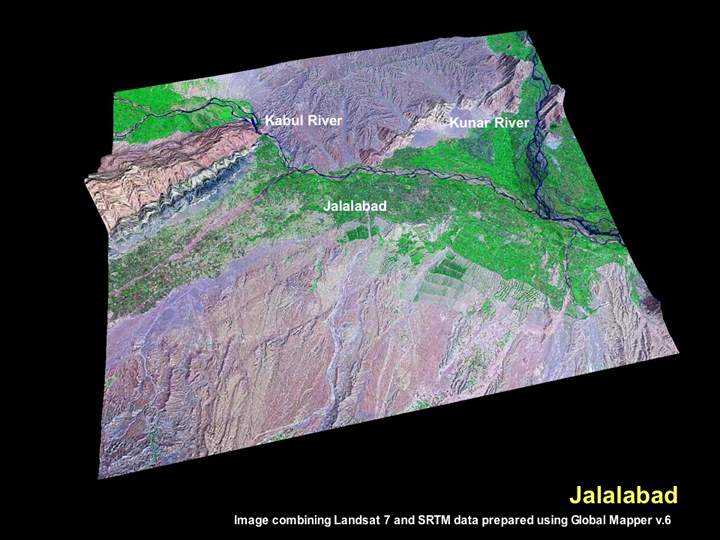
The modern town of Jalalabad lies close to the junction of the Kabul and Kunar Rivers. The plains around the town are demarcated by a series of ridges and dissected by the two rivers, as is clearly shown in this image that combines the detail of a Landsat 7 image with the topography of the SRTM data.
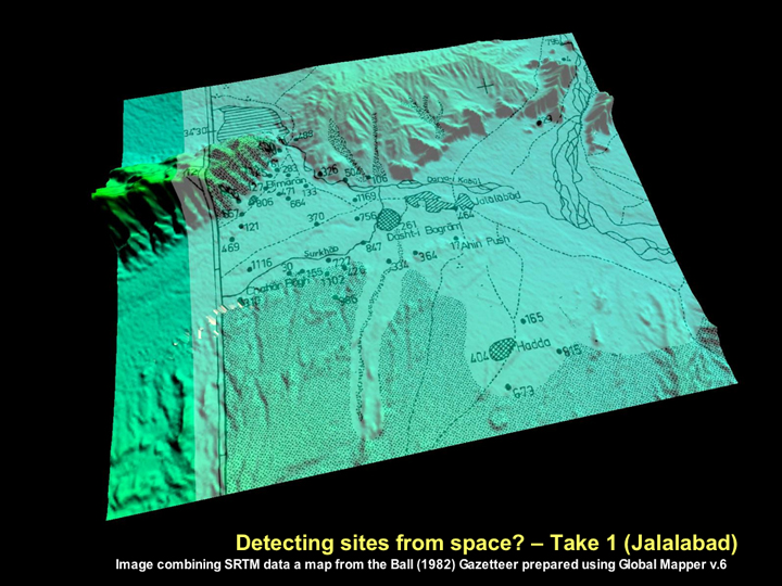
By overlaying a scanned map from the Ball (1982) Gazetteer on top of the SRTM data for the region, it is possible to get an impression of its archaeological landscape. While there are several archaeological sites in the area, it is somewhat disappointing to note that the nature of the topographic relief in this region makes is particularly difficult to readily identify any of the archaeological sites on the SRTM image.
Whilst this may reflect the nature of the sites in this region, it must be acknowledged that there are inherent difficulties with geo-referencing such maps, and the reliability of the topography will be constrained by the reliability of the original survey maps that were used. As such, the relatively straightforward and high-yield tell-spotting using SRTM data that was possible for the plains of Northern Mesopotamia (Sherratt 2006: visit ArchAtlas Tellspotting) is unfortunately not feasible in this broken landscape. As will be discussed below, for many regions, it may be necessary to use higher resolution imagery.
◄ Return to Remote Sensing in Inaccessible Lands