 Occasional Papers (2009-)
 Site Visualisations
Kabul and Parwan Valleys
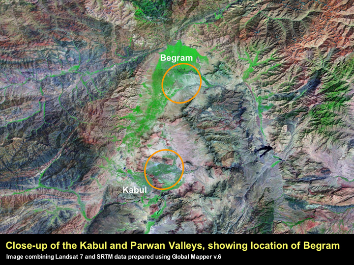
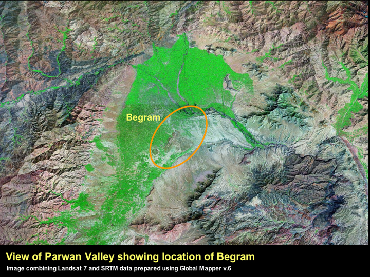
We know relatively little about the early city of Kabul, as systematic excavations have not yet been carried out at any of the large mounds that still stand throughout the modern city (Ball 1982: 136-7). Historically, the major city in Parwan was Begram, which was also known as Kapisa (Ball 1982: 55). Situated some 60 kms north of Kabul, excavations were carried out at Begram in the 1930s and 40s (see below).
Kabul city is situated in a mountainous valley where the geography constrains human settlement. This can be clearly seen in this image that combines the detail of a Landsat 7 image with the topography of the SRTM data.
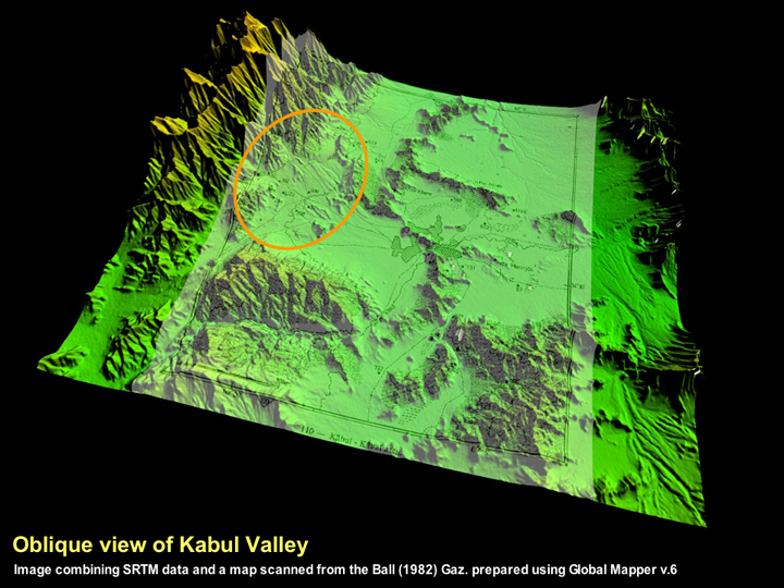
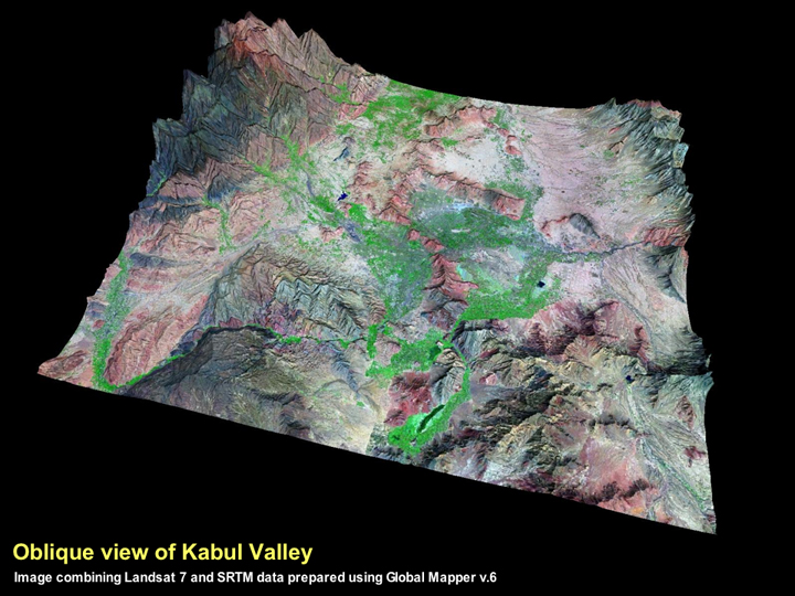
When the relevant map from the Ball (1982) gazetteer is draped onto the SRTM data, it is possible to get an impression of its archaeological landscape of the Kabul Valley. Most of the archaeological sites towards the centre of the valley are now within the bounds of the modern city, which is considerably larger than it was in the late 1970s, as can be seen by comparing the outline of the city in the image shown above with the previous image with the Landsat 7 data that showed the extent of the modern town.
The area to the west of Kabul city (demarcated by the orange circle) appears to lie outside the area of expanded settlement and to have potential for the detection of archaeological sites from space.
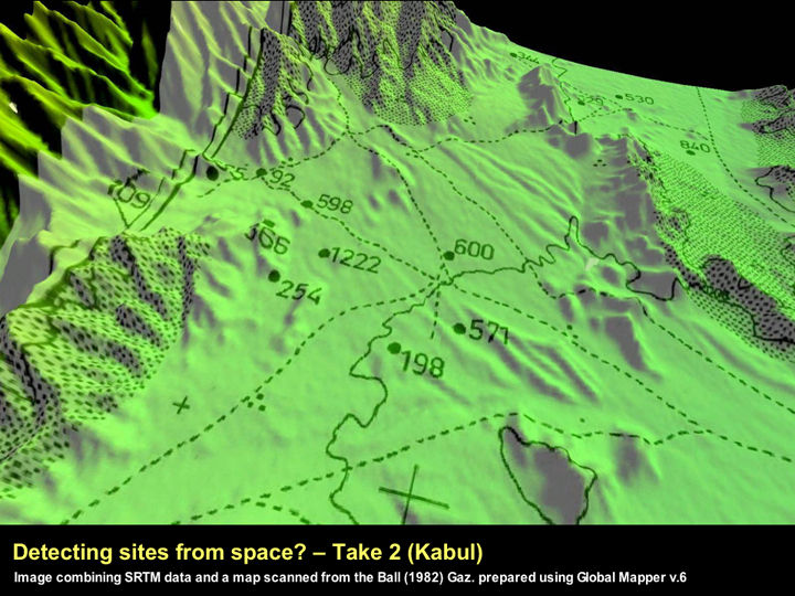
As can be seen from the close-up of the SRTM image draped with the map from the Ball (1982) gazetteer, the landscape in this area is quite irregular and as with sites in the Jalalabad region, the nature of the topographic relief makes is particularly difficult to readily identify any of the archaeological sites on the SRTM image.
Whilst this may reflect the nature of the sites in this region, it must be acknowledged that there are inherent difficulties with geo-referencing such maps, and the reliability of the topography will be constrained by the reliability of the original survey maps that were used. As such, the relatively straightforward and high-yield tell-spotting using SRTM data that was possible for the plains of Northern Mesopotamia (Sherratt 2006: visit ArchAtlas Tellspotting) is unfortunately not feasible in this broken landscape. As will be discussed below, for many regions, it may be necessary to use higher resolution imagery.
Thanks to the excavations conducted at Begram, we know considerably more about the archaeological history of the fertile Parwan region. However, the area of Begram has been subjected to a far more specific and unusual threat.
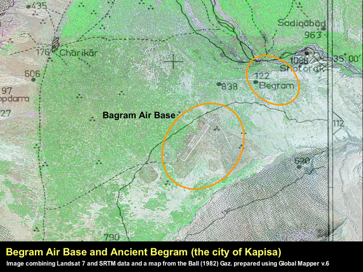
The ancient site Begram is situated in close proximity to the recently expanded Bagram Air Base. In the media, it is generally claimed that the Bagram Air Base is in fact located at the ancient city (e.g. http://en.wikipedia.org/wiki/Bagram_Air_Base Bagram Air Base at Wikipedia). However, a careful look at the satellite imagery thankfully reveals that this is not actually the case.
Ball's site distribution map shows that a number of archaeological sites are particularly close to the air base's runways and associated outbuilding and its likely that these have now been destroyed. However, the city of Begram lies to the northeast of the airfield, on the banks of the Panjshir River.
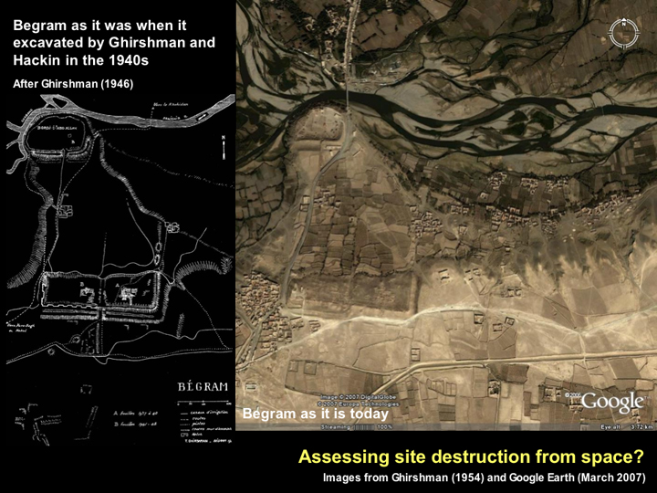
Thanks to the high resolution images that are available for parts of the world on Google Earth, Ancient Begram is an ideal candidate for assessing the level of site destruction that has taken place at a major ancient city. A comparison of the map of the site prepared by Ghirshman (1946) and the Google Earth image shows that the site is relatively well preserved. In fact, the buildings that were recorded as being within the sites' environs in the 1930s are still the only buildings visible actually on the site. There is a modern road crossing the site, but this appears to be a metalled version of the 1930s track and in the southern area close to the fortification wall, it is actually possible to make out the location of Hackin and Ghirshman's excavation trenches (Ghirshman 1946; Hackin 1954). This is encouraging.
◄ Return to Remote Sensing in Inaccessible Lands