 Occasional Papers (2009-)
 Site Visualisations
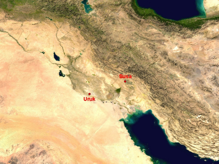
NASA Blue Marble true-colour global imagery [1km resolution]
Location map: the Near (Middle) East showing the locations within Iran of the major Bronze and Iron Age sites of Susa and Tepe Sialk.
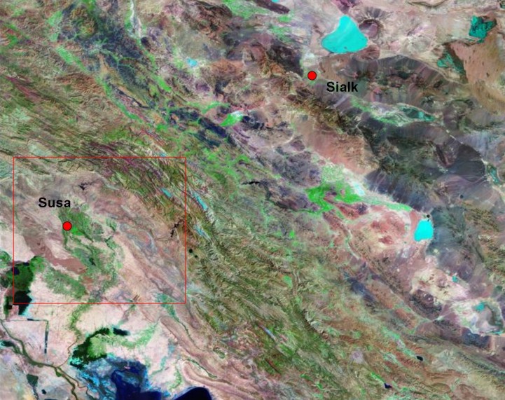
Landsat image,30m resolution, circa 1990, with Band 7 displayed as red, Band 4 as green and Band 2 as blue.
Landsat TM imagery provided by NASA.
Relative locations of Susa and Sialk on either side of the Zagros mountains (green ridges running diagonally across the image). Susa lies in the irrigated alluvial plain of Susiana (modern Khuzestan), Sialk on the edge of the arid Iranian plateau, important for its metal sources. See also Cameron Petrie's Routes and Plains in Southwest Iran, especially on the Susiana plain.
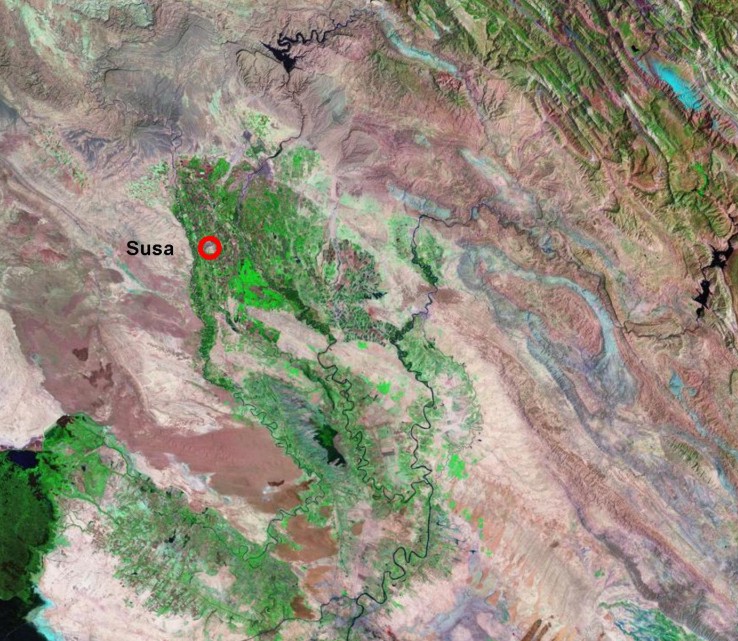
Landsat TM imagery provided by NASA.
Location of Susa within the irrigated alluvial plain of Khuzestan, a well-watered plain between the Persian Gulf to the south and the Zagros mountains to the north.
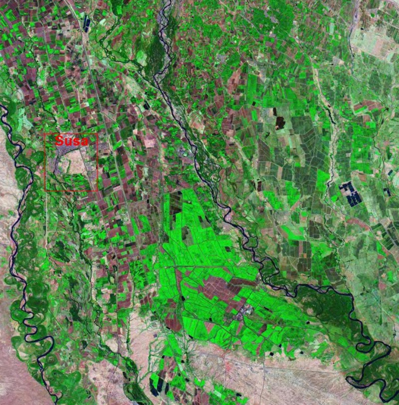
Landsat TM imagery provided by NASA.
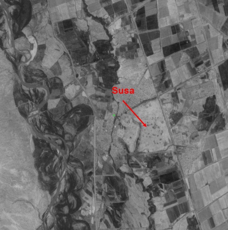
Position of Susa (now visible as the pink oval within the box) on the River, between the larger Karkheh and Dez rivers. Mechanical pumps allow a larger area to be irrigated than in earlier times
Landsat TM imagery provided by NASA.
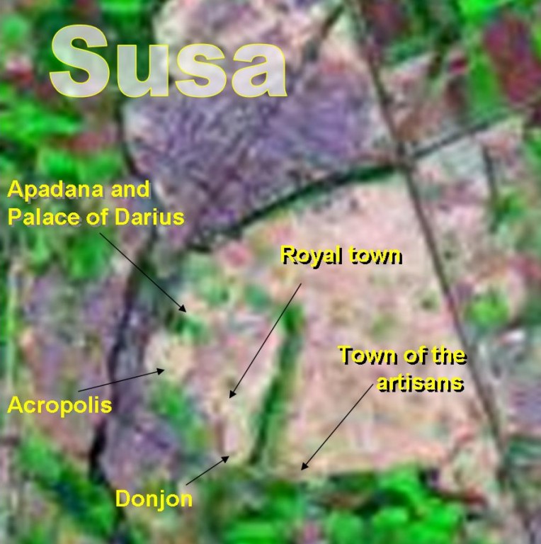
Enlarged segment of the previous image, showing areas of the site identifiable on the image. The Donjon is the fortified dig-house of the French expedition to Susa.
SPOT panchromatic image, orthorectified, 10m resolution.
CNES/SPOT imagery, provided by NIMA (D01-10M) derived from data obtained from the SPOT Image Corporation under an unrestricted license. CNES/SPOT Image 1992-1994.
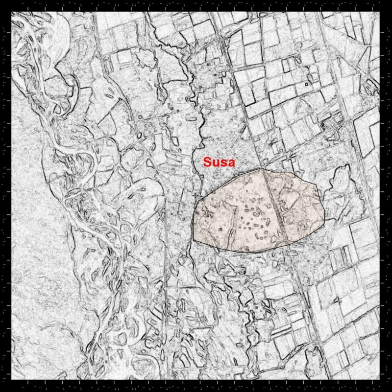
Black and white panchromatic image centred on Susa, with the wide meandering floodplain of the Karkheh to the left (west).
CNES/SPOT imagery, provided by NIMA (D01-10M) derived from data obtained from the SPOT Image Corporation under an unrestricted license. CNES/SPOT Image 1992-1994.
Digitally enhanced version of the previous image selecting for edges, indicating the approximate outline of the site (tinted).
Referenced sites
| Site Name | Country | Latitude | Longitude | OpenAtlasID |
|---|---|---|---|---|
| Susa | ir | 32.19 | 48.25 | ir/susa |