Important news about the threat to the Dept of Archaeology at the University of Sheffield... Read more...

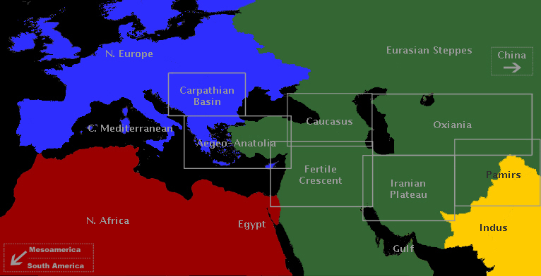
Oxiania

Mapping the Silk Road
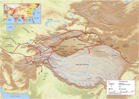
Little was known of the remarkable heritage of the Silk Road until explorers and archaeologists of the early twentieth century uncovered the ruins of ancient cities in the desert sands, revealing astonishing sculptures, murals and manuscripts. One of the most notable discoveries was the Buddhist cave library near the oasis town of Dunhuang on the edge of the Gobi desert in western China. The cave had been sealed and hidden at the end of the first millennium AD and only re-discovered in 1900. Forty thousand manuscripts, paintings and printed documents on paper and silk were found in the cave itself. Tens of thousands more items were excavated from other Silk Road archaeological sites. These unique items have fascinating stories to tell of life on this great trade route from 100 BC to AD 1400. Yet most were dispersed to institutions worldwide in the early 1900s, making access difficult. The size and scope of the collections, as well as their fragility and limited access, has meant that, while they constitute a primary research resource for the history and literature of the region, many of the manuscripts in particular have yet to be studied in detail. The International Dunhuang Project aims to reunite this material by making it freely available online. One part of this project includes the mapping of archaeological sites, and the digitisation of data from archaeological data collected by Aurel Stein and other researchers, using tools such as Google Earth to help users to better understand the history of the Tarim Basin and its cultures.

Trade networks in the Karakum

In our imagination of the 'Silk Routes', we envisage travellers, traders and intellectuals traversing vast continents for the purpose of exchanging rare and precious items. The archaeological study of these routes has usually focused on transmitted artefacts and ideas, as opposed to the means and methods by which they were carried. The resultant void of knowledge concerning the infrastructure of the Silk Roads, and the nature of the settlements that shaped and were shaped by them, presents a challenge to archaeologists from both a methodological and theoretical perspective.

Pathways and Highways

This visual essay explores the possibility of delineating two different types of routes, 'pathways' and 'highways', and the extent to which archaeology can help to analyse them. The technologies of cost-raster GIS analysis are introduced and applied to two case studies in Eastern Anatolia and Western Central Asia, c. 3000-1000 BC. It is to be hoped that the highlighted patterns, combined with a knowledge of contemporary material transformations, will provide insights into the processes of socio-economic change across these reconstructed networks of interaction.

East-West Contacts in Eurasia

Connections between the eastern and western ends of Eurasia began in the Bronze Age: China and the West co-evolved. A global viewpoint shows how this happened, first across the forests of Siberia, then by the steppes and oases of the Silk Road, then increasingly by sea, via the Indian Ocean. This is a human story of cultural encounter, exchange and creativity – and, ultimately, geo-economics.

Trade Routes: Growth of Global Trade

One of the most evident features of the human past is the growing scale of connections between areas, shown for instance by the movement of materials (such as the Obsidian Trade). Although the current phase of "globalisation" is unique in its range and impact, it was preceded by many earlier episodes of expansion and collapse. These maps reconstruct how such networks develop, and show how they follow a logic reflecting both their own geometry and that of the Earth's surface, and how they sometimes come to a catastrophic stop.