Important news about the threat to the Dept of Archaeology at the University of Sheffield... Read more...

Aegeo-Anatolia

Networks of interaction in Early Bronze Age Anatolia
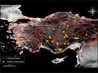
Research carried out in Turkey over the last few decades seems to indicate that the Early Bronze Age in west and central Anatolia was a period in which new socio-political structures emerged whose mature development is reflected in the territorial entities of the Old Assyrian period. From the second half of the third millennium, we have evidence of social stratification both at the intra-site and inter-site level, accompanied by a wealth of prestige goods and public structures displayed in settlement and funerary contexts. This phenomenon is also paralleled by the rapid growth of long-distance relations both within Anatolia and with surrounding regions, at least partially triggered by the rise in metal demand of local and foreign elites.

Levant Harbour Towns in the Middle Bronze Age

Trading connections and routes play a very important part in the development (or re-development) of urban centres in the Middle Bronze Age Levant. This is particularly clear in the regions of Cilicia and the Amuq Plain in the Hatay, in the north-east corner of the East Mediterranean, where at the beginning of the Middle Bronze Age we have evidence of large-scale public buildings and fortification systems which represent the revival of complex political and economic structures, following a collapse at the end of the Early Bronze Age. A key role in this is played by harbour towns on the Cilician and Levantine coasts, which have an important part in the articulation and exploitation of maritime and inland routes connecting different zones and their resources. This in turn leads, by the beginning of the Late Bronze Age, to the formation of a symbiotic network of semi-dependent kingdoms which link these different inland and coastal zones in a single interactive socio-economic system.

Pathways and Highways

This visual essay explores the possibility of delineating two different types of routes, 'pathways' and 'highways', and the extent to which archaeology can help to analyse them. The technologies of cost-raster GIS analysis are introduced and applied to two case studies in Eastern Anatolia and Western Central Asia, c. 3000-1000 BC. It is to be hoped that the highlighted patterns, combined with a knowledge of contemporary material transformations, will provide insights into the processes of socio-economic change across these reconstructed networks of interaction.

The Obsidian Trade in the Near East, 14,000 to 6500 BC

Obsidian, a black volcanic glass, was first recognized by Colin Renfrew and his colleagues J.E. Dixon and J.R. Cann in the 1960s as a uniquely sensitive indicator of prehistoric trade, both because of the great desirability of this material before the use of metals, and also because the trace-elements it contains are usually diagnostic of individual sources. Based on data extracted from M.-C. Cauvin et al., L'obsidienne au Proche et Moyen Orient: du volcan à l'outil (Oxford: BAR Int. Ser. 738), maps indicate the flows of material from two major source-areas.

Portages

Early trading networks carried relatively small quantities of valuable goods, often over considerable distances, both by land and water. The relationship between overland transport and carriage by river or sea helps to explain why trading centres rose to prominence at certain key positions on these routes. With very small quantities of goods, light vessels might be carried over short distances between rivers; and even when the bulk of traded goods increased, it might still be advantageous to carry the goods for short distances overland from one port to another. Sites at such break-of-bulk points became major nodes in the transport network. This presentation explores the changing geometry of early trade-routes, and especially the interface between land and sea.

Trade Routes: Growth of Global Trade

One of the most evident features of the human past is the growing scale of connections between areas, shown for instance by the movement of materials (such as the Obsidian Trade). Although the current phase of "globalisation" is unique in its range and impact, it was preceded by many earlier episodes of expansion and collapse. These maps reconstruct how such networks develop, and show how they follow a logic reflecting both their own geometry and that of the Earth's surface, and how they sometimes come to a catastrophic stop.